| More Mining Explorations Bowers Mtn & Cove - Gold Mines Union County, GA |
All Text & Images: Copyright (2023) |
| More Mining Explorations Bowers Mtn & Cove - Gold Mines Union County, GA |
All Text & Images: Copyright (2023) |
| December 2023 The Coosa Creek gold belt was primarily mined by placer operations, but in later phases, some hard rock mining (tunneling) took place. In past years I had explored some of the placer operations, as well as the fairly well known Coosa Mine tunnel (technically an adit, since a true tunnel has two openings...). While reading some old gold reports, I saw a paragraph in the Coosa Belt section that read in part "Close to the headwaters of the creek, prospecting has been done at different times in endeavors to locate vein deposits. About 12 years ago, on Lot XXX, 10th district, a tunnel was run into the hillside on Wellborn Mountain. Some small stringers of quartz exposed in the tunnel are reported to be auriferous. Limited operations have recently been in progress at this locale, but until the work has progressed, nothing definite can be stated." Studying LIDAR imagery, I determined where these operations had taken place (even though the report misnamed the mountain), and saw many indications of probable mining operations. My friend Sheldon and I climbed up there to explore, and in addition to numerous prospect pits, trenches and shafts, (and maybe one collapsed tunnel), we found a nice adit almost 150 feet in length. |
|
 |
|
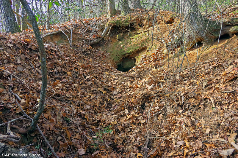
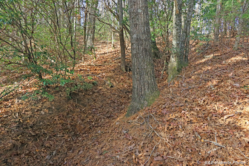
| Could that be an adit (tunnel) at the end of this mine cut? |
|
 |
|
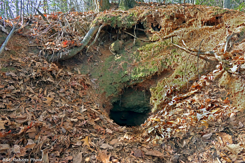
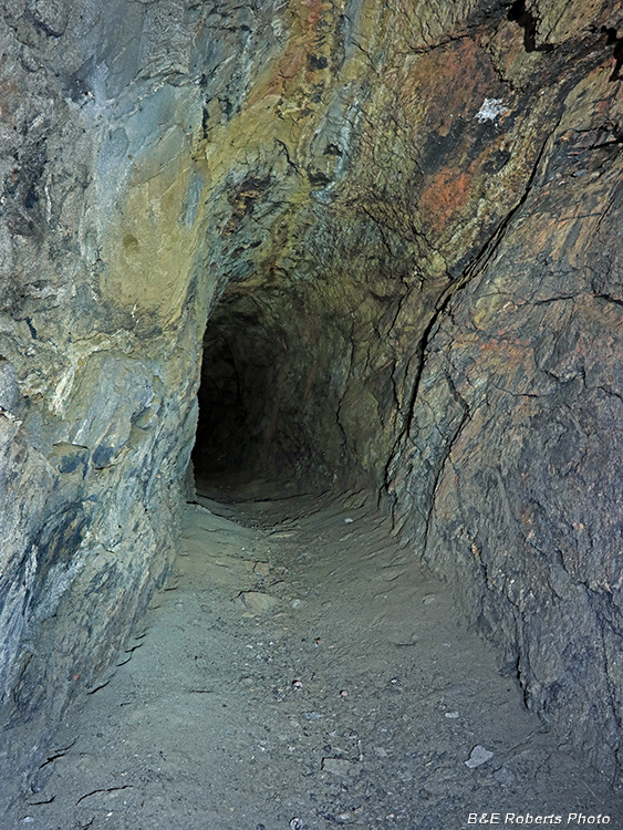
| It's definitely the entrance into an adit. The mouth was partially slumped, but there was plenty of room to slip inside. |
|
 |
|
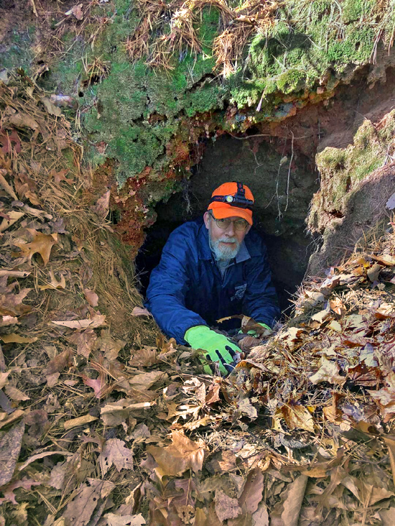
| Yours truly, in the mouth of the adit. (Photo by Sheldon) |
|
 |
|
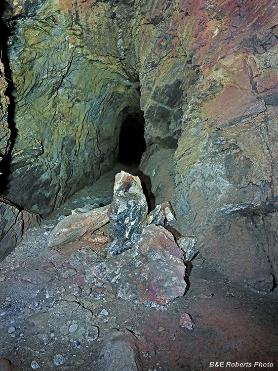
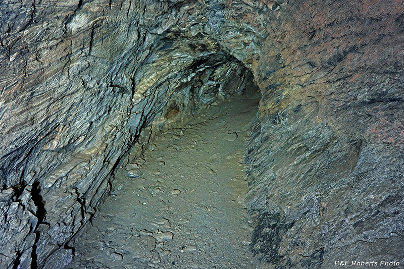
| Front section of the adit. A few rocks had collapsed from the ceiling near the entrance. |
|
 |
|
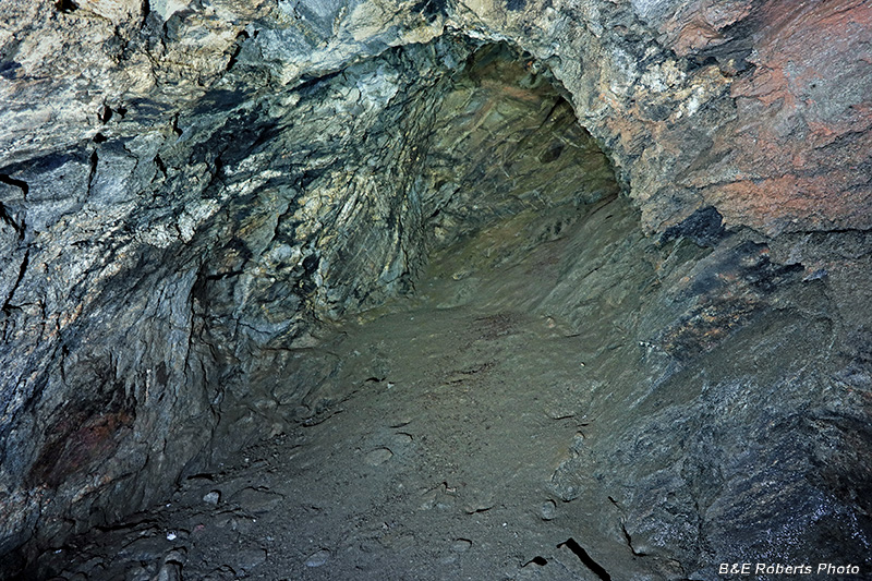
| Further along... This was one of tallest adits I have ever explored. I usually have to bend down some, but this one was almost eight feet in height. |
|
 |
|
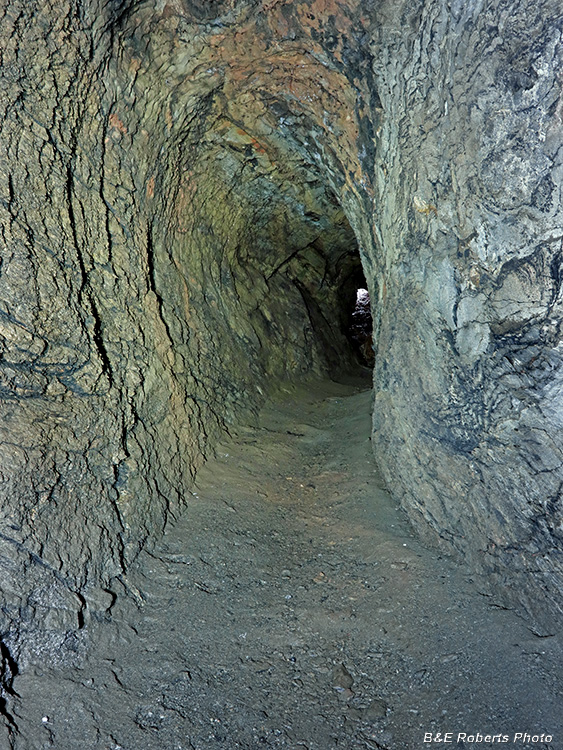
| Getting near the end of the adit. About 150 feet deep. |
|
 |
|
| The final diggings sloped upwards to the right, but then ended. |
|
 |
|
| Heading back. The adit had a few slight curves along its length. |
|
 |
|
| Getting closer... |
|
 |
|
| Collapsed ceiling rocks that I passed on the way in. |
|
 |
|
| Adit entry (or exit, at this point), from the inside... |
|
 |
|
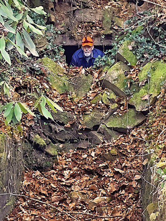
| After I climbed out, Sheldon took a turn exploring inside. |
|
 |
|
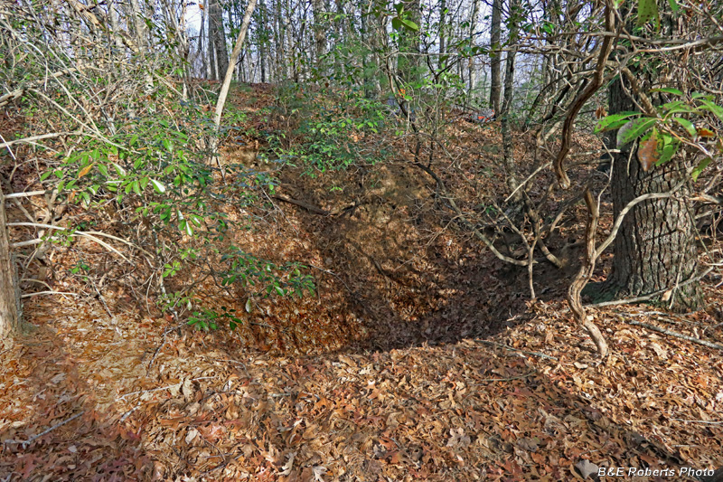
| Another slumped mining cavity; this one is only about 5-6 feet deep. |
|
 |
|
| Large mine shaft, partially collapsed We decided this was a good spot to break for lunch. |
|
 |
|
| One of many prospect trenches cut in the area. |
|
 |
|
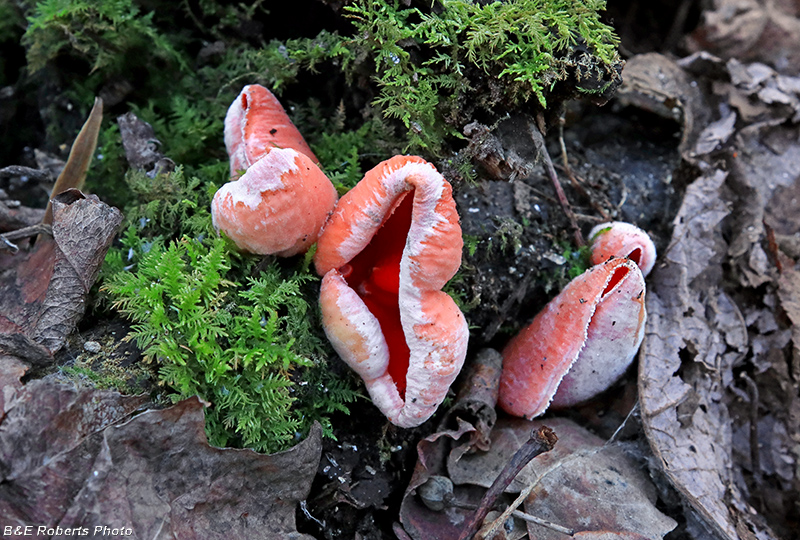
| Scarlet Elf Cups (Sarcoscypha species, maybe S. austriaca) These appeared to be old, as they were dried out and curled up. |
|
| We'd heard that there was another adit (of unknown length) somewhere lower on the mountain, and I thought I had detected it on LIDAR. After descending the mountain, we drove over to Bowers Cove to look for it from there. Unfortunately, the indication I had marked was just a small mine pit (I didn't take any pics). |
|
 |
|
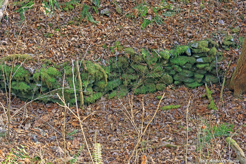
| Walking along the creek to the LIDAR indication, we passed a number of ground sluice walls from the placer mining days. |
|
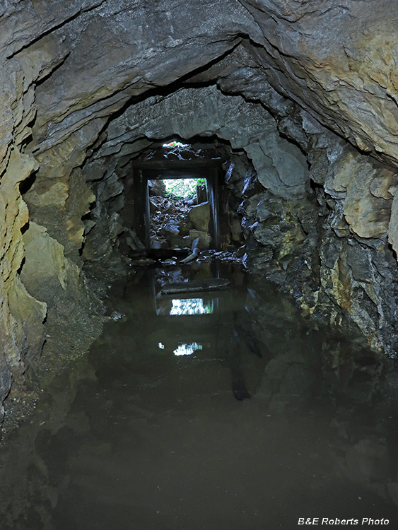
| I hadn't been to the "main" Coosa Creek gold mine adit in several years. It was wet the last time I'd visited, and I thought that it might be drier now, due to the drought we'd been in for several months. |
|
 |
|
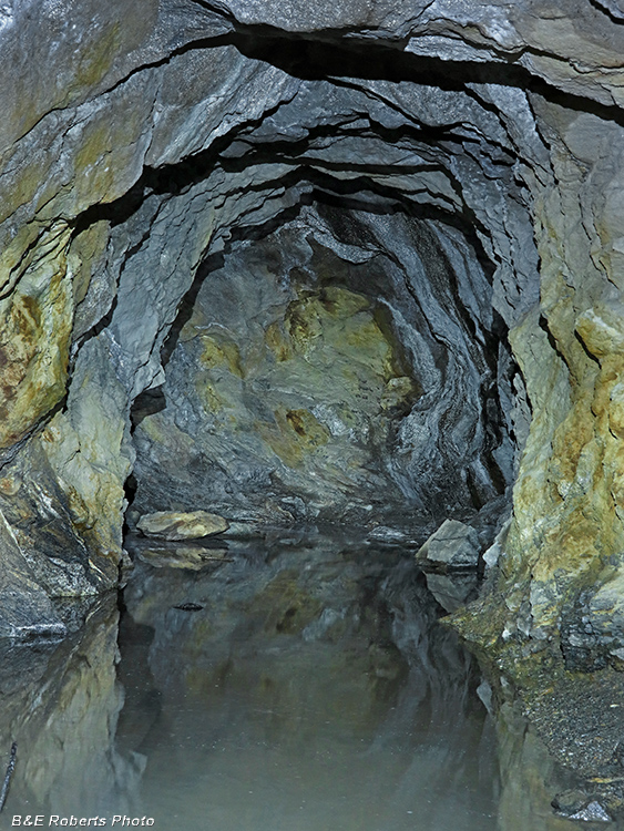
| As it turned out, there was more water than the last time I was here! |
|
 |
|
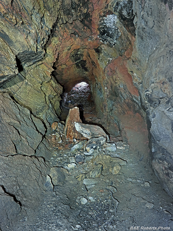
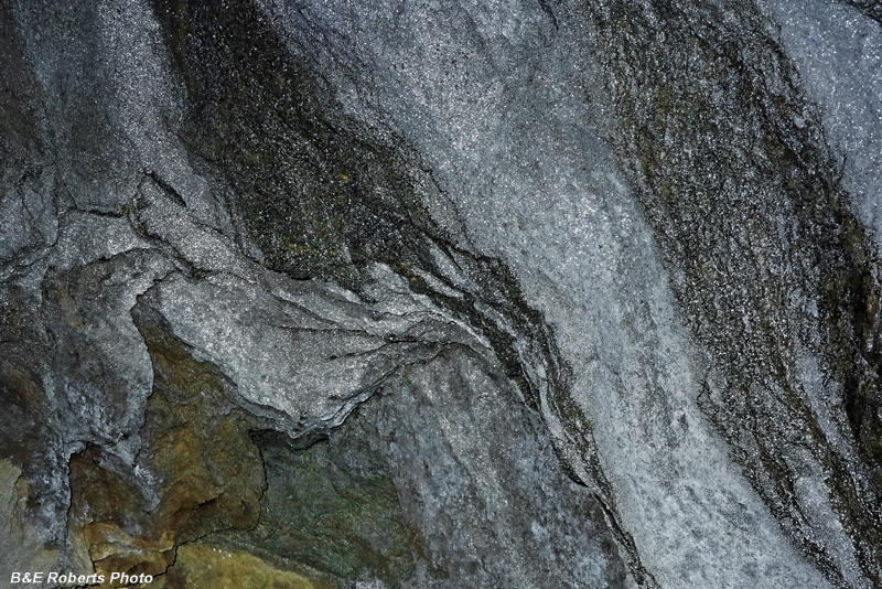
| Portion of tunnel wall and ceiling |
|
 |
|
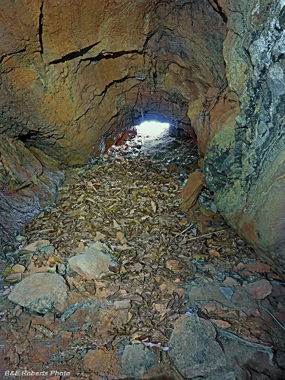
| View back to the adit entrance. |
|
 |
|
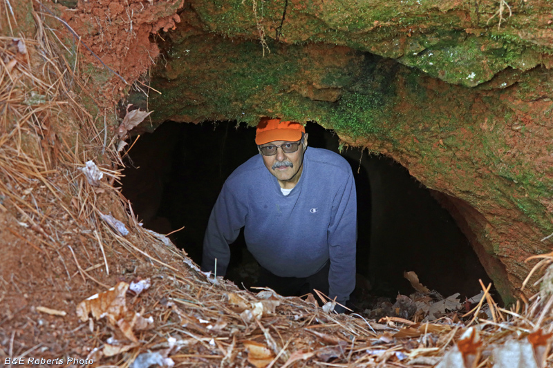
| Emerging from the adit (Photo by Sheldon) |
|
 |
|
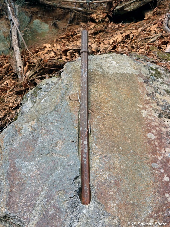
| Nearby, an old drill rod is embedded in the rock. |