| A Climb to Tusquitee Bald via Big Tuni Creek Nantahala National Forest, Clay Co. |
All Text & Images: Copyright (2018) |
| A Climb to Tusquitee Bald via Big Tuni Creek Nantahala National Forest, Clay Co. |
All Text & Images: Copyright (2018) |
| With over 2000 feet of elevation change in 3.2 miles, Tusquitee Bald via the Chunky Gal Trail is a fairly rigorous hike. It was mostly blue skies when I left home, but naturally by the time I was approaching the summit, I was socked in by clouds. All I could see was white fog in all directions, but I decided to wait it out and shoot some Gentians that were growing nearby. The overcast lifted a few times, and I managed a few panoramic photos, but it always closed back in within minutes; I never did have anything approaching clear skies. And sadly, what used to be a "bald" is quickly being taken over by saplings and other growth. October 2018: |
|
 |
|
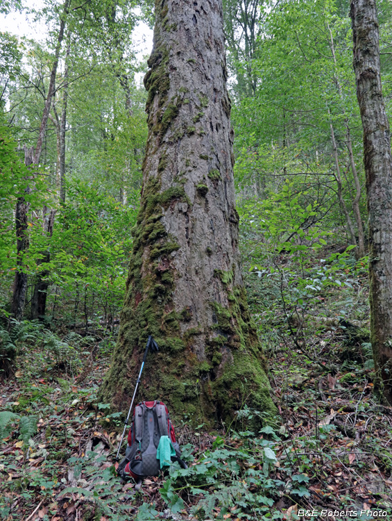
| One of several large old Buckeye trees along the trail... I didn't take many photos along the hike up the trail. I had previously been along the lower (easiest) third of the trail (click here for album), and after reading old reports about the condition of the upper trail, I wanted to allow myself plenty of time to reach the summit and explore. |
|
 |
|
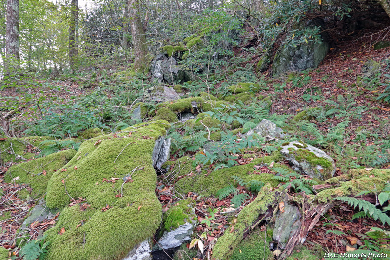
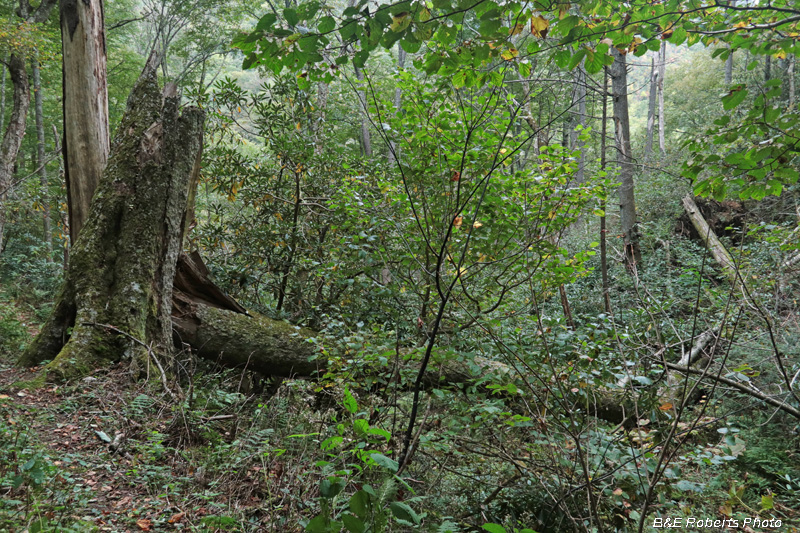
| Climbing a spur ridge that connects to Dead Line Ridge, the trail passes through several small boulderfields |
|
 |
|
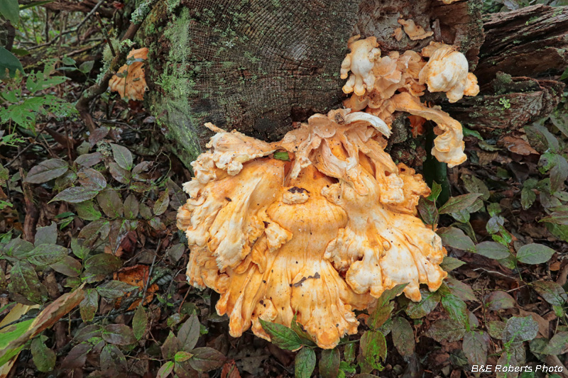
| I believe this is an old Chicken of the Woods (Laetiporus sp.) |
|
 |
|
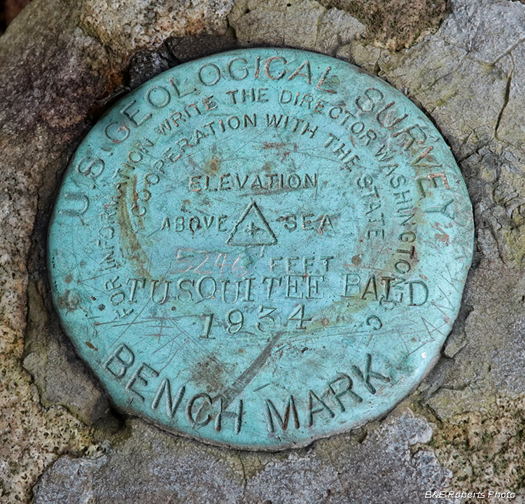
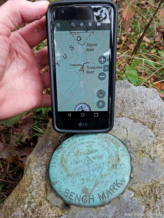
At the summit of Tusquitee Bald USGS Benchmark - 5246 feet elevation |
|
 |
|
 |
|
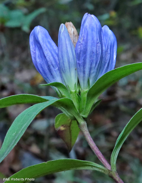
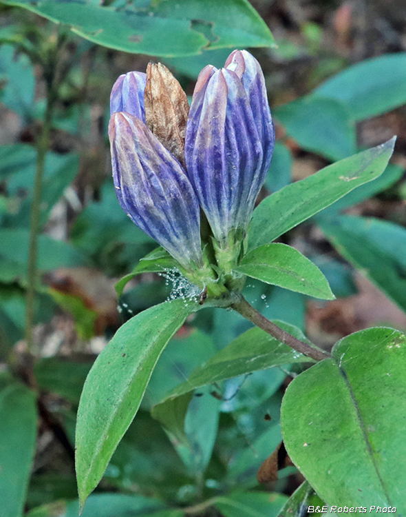
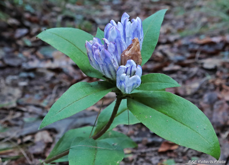
| Showy Gentians (Gentiana decora) |
|
 |
|
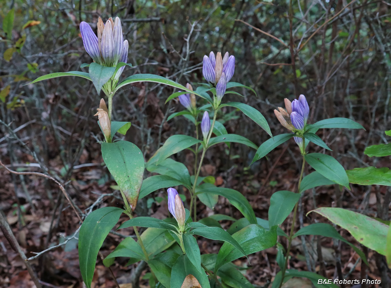
| There was a nice colony of these Gentians blooming at the summit |
|
 |
|
| The small calyx lobes indicate this species, vs. Soapwort Gentians. |
|
 |
|
| Gentiana decora |
|
 |
|
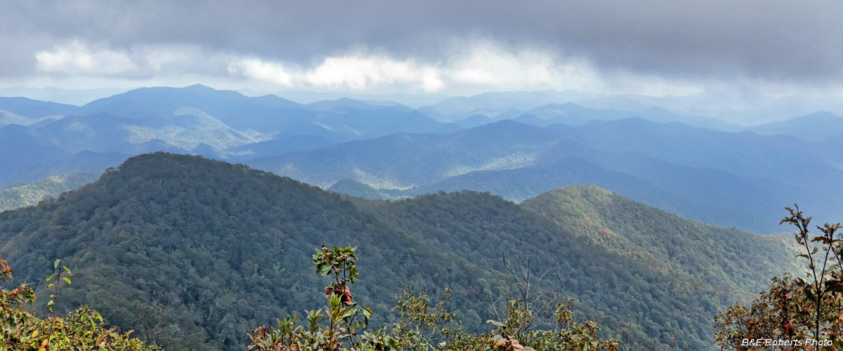
| View looking east from Tusquitee Bald. One of the few moments when I wasn't inside the clouds... |
|
 |
|
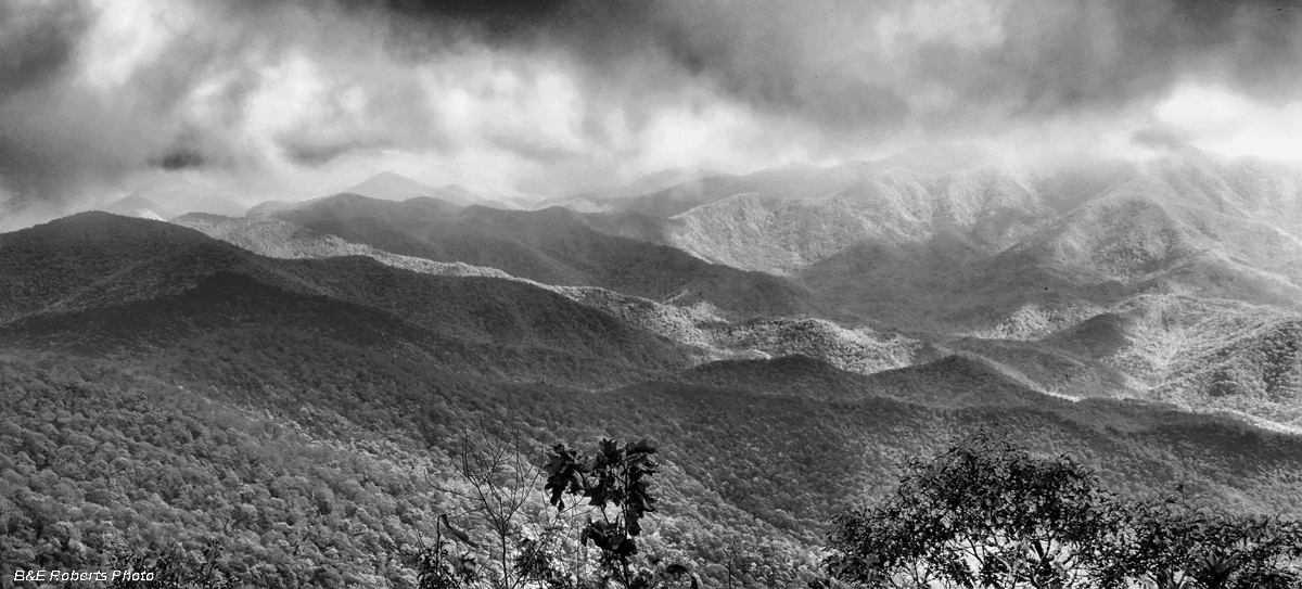
| Looking somewhat to the right of the previous view, this B&W image looks down into the upper Tusquitee Valley, with Boteler Peak's summit hidden in the clouds on the right horizon. Perry Gap would be near the center of this image. |
|
 |
|
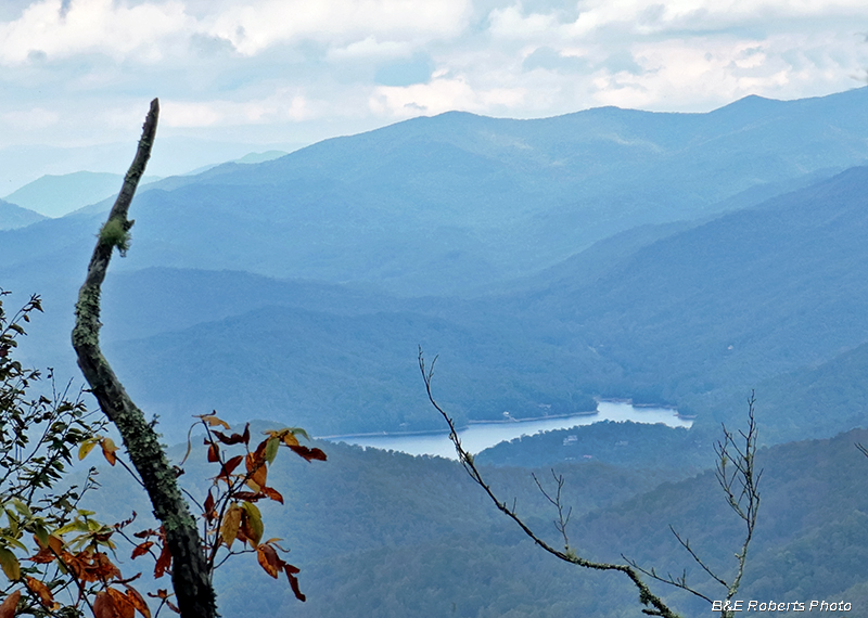
| Heading back down, a gap in the trees gave a view NE to Nantahala Lake. |
|
 |
|
| Where the trail begins to descend Dead Line Ridge, there was some temporary confusion as some blowdown had resulted in several diverging walk-arounds. But I quickly recovered. |
|
 |
|
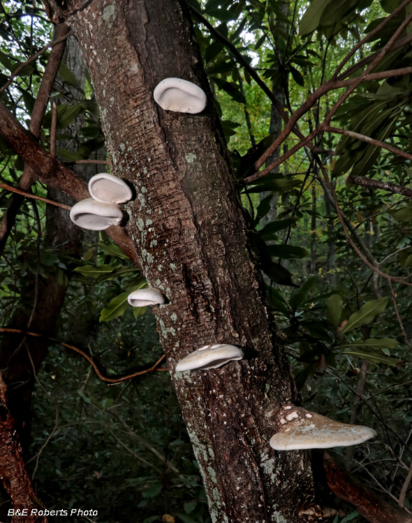
| Possibly Birch Polypore (Fomitopsis betulina) |
|
 |
|
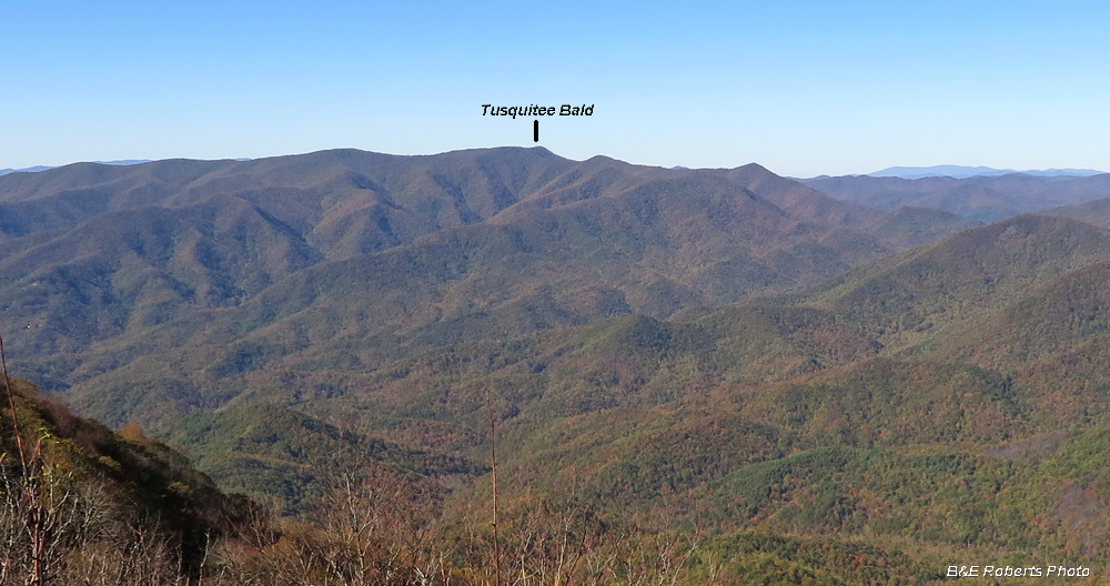
| For reference - here's a 2017 view of Tusquitee Bald (and the Tusquitee Range) taken from Boteler Peak. Dead Line Ridge, the final approach to the Bald, is seen to the right of the prominence. |