| Mysterious Wall on Soapstone Mtn. LRWMA, Stephens Co., GA |
All Text & Images: Copyright (2020) |
| Mysterious Wall on Soapstone Mtn. LRWMA, Stephens Co., GA |
All Text & Images: Copyright (2020) |
| When I saw that the nearby FS road was going to be open for a few days, I went over to explore the rock wall on Soapstone Mountain. This mysterious wall, about a half mile long, runs along a steep mountainside, first climbing several hundred feet in elevation up an almost vertical face, then levelling off somewhat to more-or-less follow the mountainside contour. The wall ranges from a height of 1-2 stones up to 3-4 feet in places; in several locations the stacked stone wall incorporates the natural stone bedrock in the area. A great number of the stones have become dislodged and fallen downslope over the decades. Many of the larger stacked stones would have taken several strong folks to lift in place. The wall has several similarities to Fort Mountain near Chatsworth. The site has long been suspected of having prehistoric (Native American) origins, since there is no way this area was farmed (there are some spots where one can barely crawl up the slope!) But recent research revealed that the wall follows fairly closely along an old unusually shaped property line from before the turn of the last century. The question is, was the wall built along the property line, or was the line established to follow an ancient wall? Why anyone would go through the time and major labor to build a wall along a small section of their property, the most inaccessible part of the property at that, is beyond me. I also explored a potential home site and found a couple of old chimney remains in the area. |
 |
|
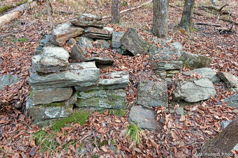
| I explored what I suspected might be an old homesite before heading for the wall. This is the remains of the first chimney I found. |
|
 |
|
| Nothing great, but it is evidence of the old home place... |
|
 |
|
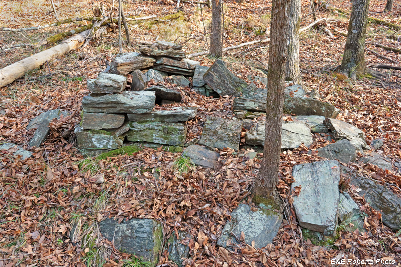
| Remains of the second chimney, a few hundred feet away. |
|
 |
|
| Not much left of this one... From the size, this may have been the chimney for an old syrup mill. |
|
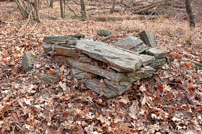
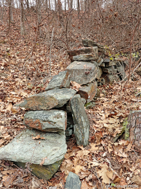
| The wall... |
|
 |
|
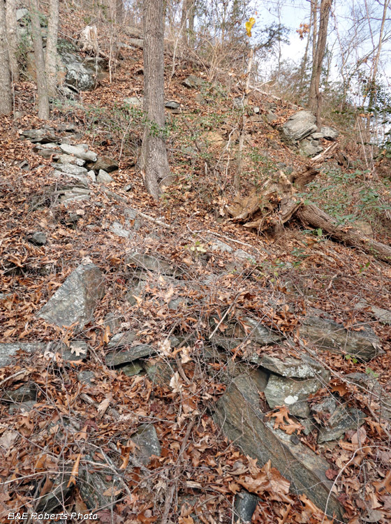
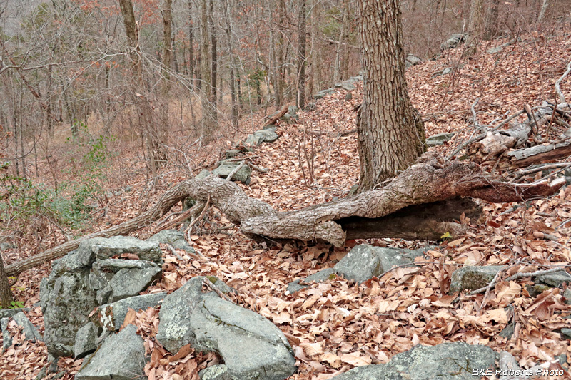
| I scrambled down a steep slope to reach the SW terminus of the wall. Somewhat indistinct in this section, the wall immediately climbs up a slope so steep that I had to grab trees to pull myself up the mountain. |
|
 |
|
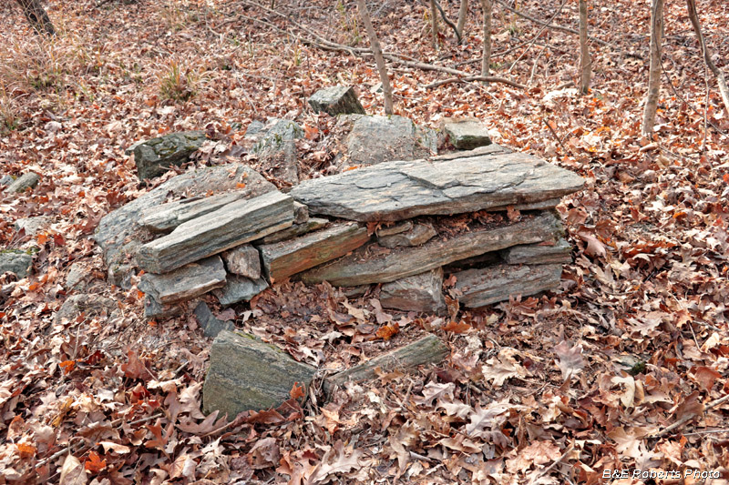
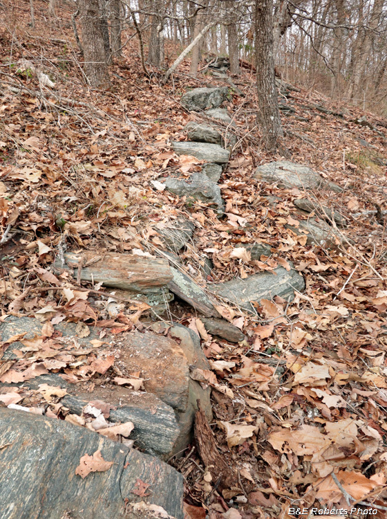
| The wall continues to climb... |
|
 |
|
| Up, up, up... The photos don't do justice to the steepness of the mountainside. |
|
 |
|
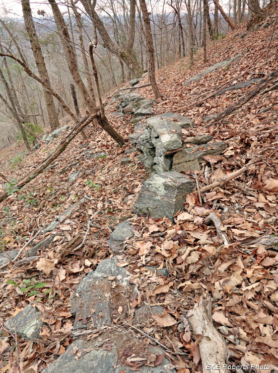
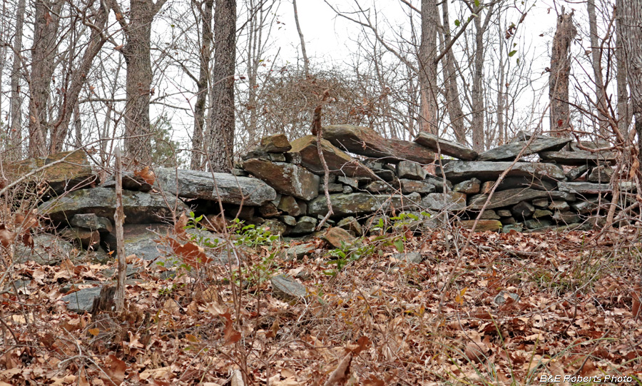
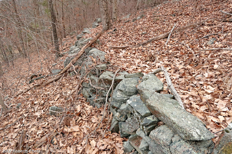
| The wall eventually levels out somewhat as it meanders to the NE.. |
|
 |
|
| Along the mountainside... |
|
 |
|
 |
|
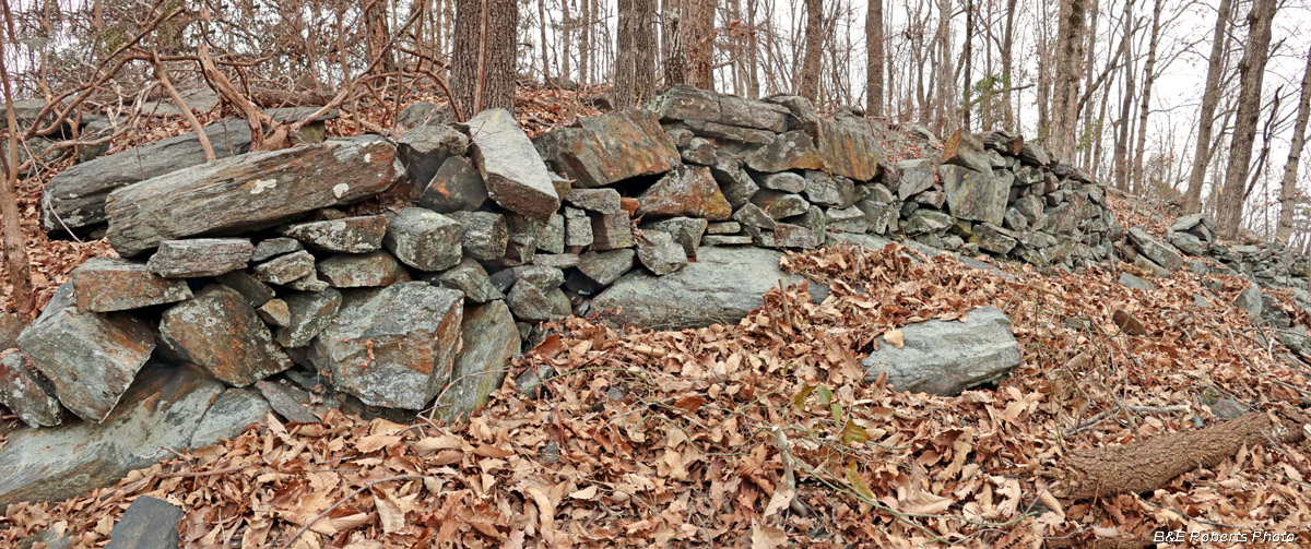
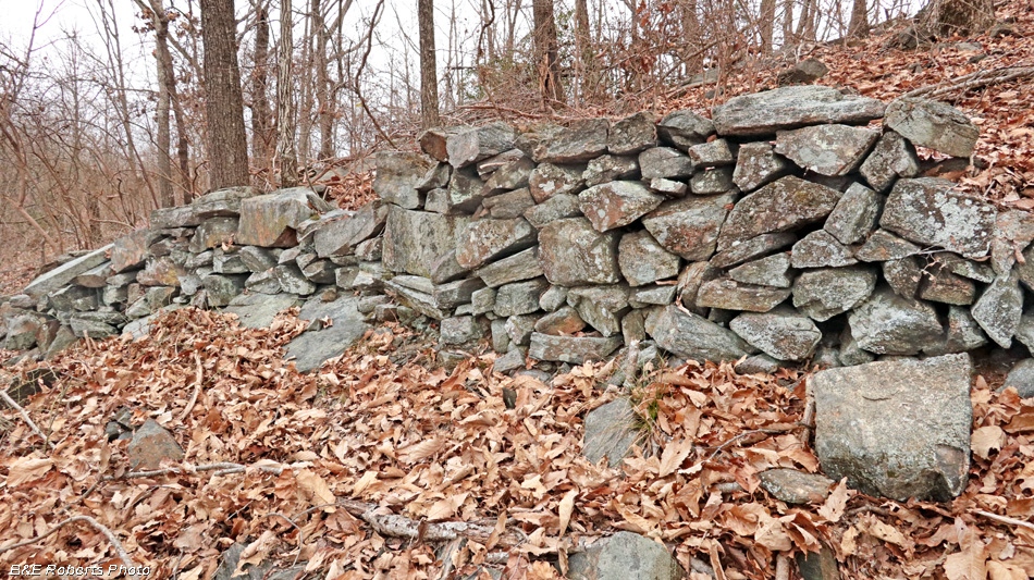
| The height of the wall increases in the middle sections... |
|
 |
|
| View back |
|
 |
|
| Looking ahead... |
|
 |
|
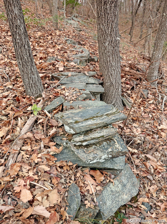
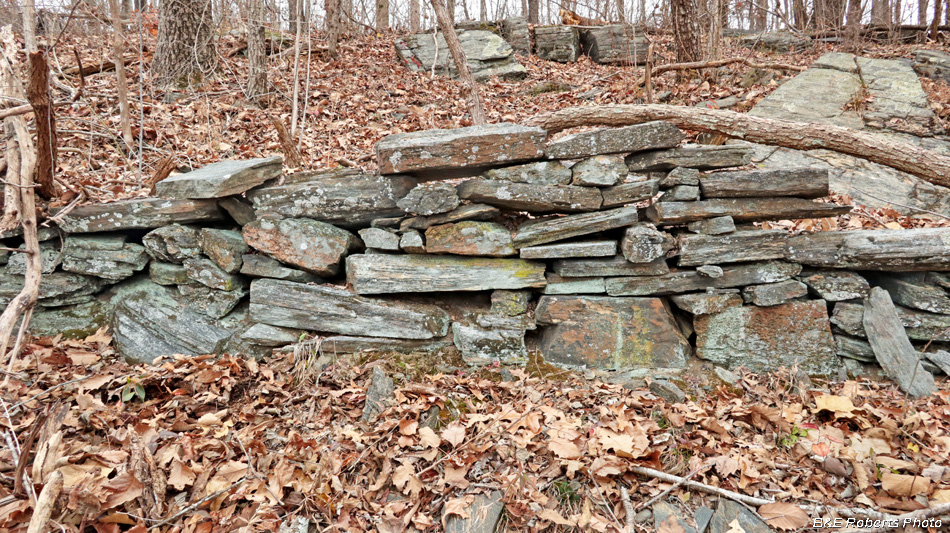
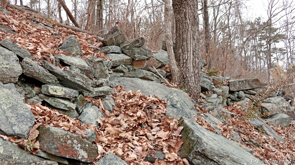
| Just look at the size of some of those rocks! |
|
 |
|
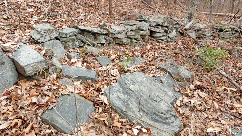
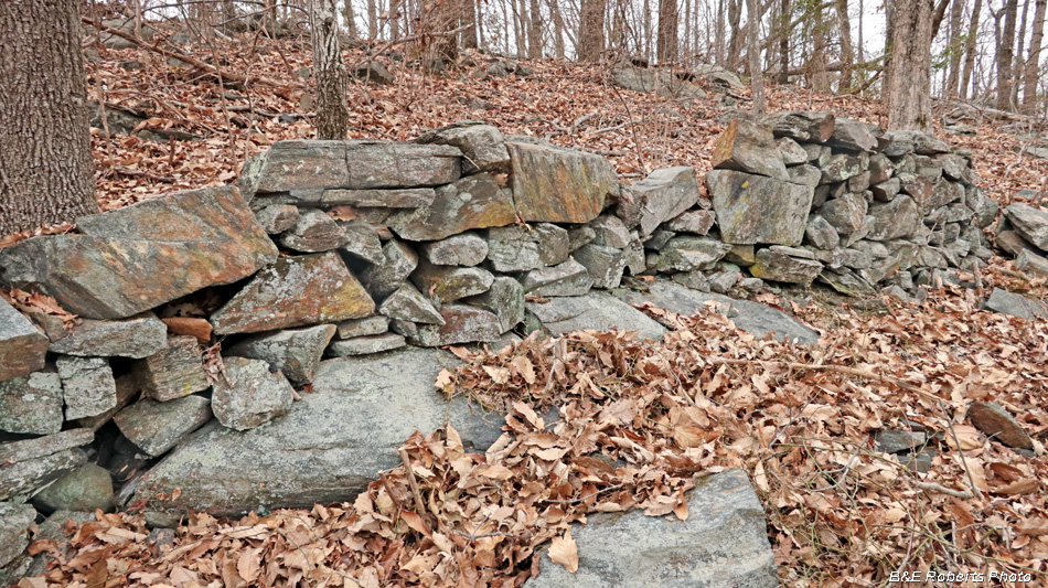
| A nice section of the wall... |
|
 |
|
| It took some major effort to stack some of these larger stones on the wall! |
|
 |
|
| Further along... |
|
 |
|
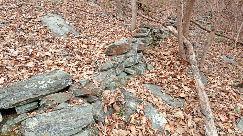
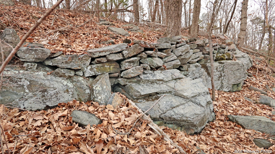
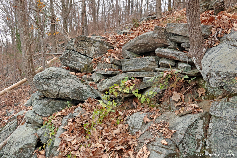
This photo and the next illustrate how, in many places, the stones are stacked on the natural bedrock ledge. |
|
 |
|
 |
|
 |
|
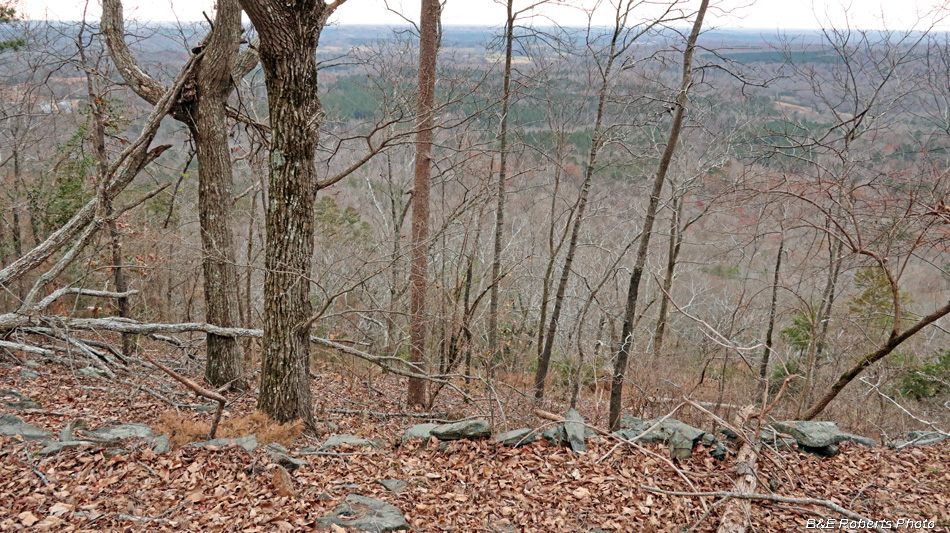
| From above the wall, looking down into the valley below. |
|
 |
|
 |
|
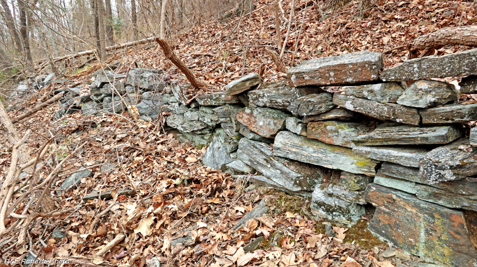
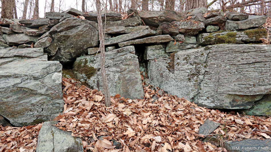
| The NE end of the wall has a lot more bedrock incorporated into the wall... |
|
 |
|
| Another section where stacked stones were placed between the natural bedrock outcrops. |