| T. H. Saxon Mica Mine Union County, GA |
All Text & Images: Copyright (2023) |
| T. H. Saxon Mica Mine Union County, GA |
All Text & Images: Copyright (2023) |
| Following a short unsuccessful search for some homesite chimneys, I drove to a nearby area that I knew held evidence of old mining activity, as well as (according to the old mining reports) the original land owner's homesite. The old home place didn't show on the early maps, so I was pretty much hunting blind, and the territory was pretty steep and rugged. Following an old overgrown road up the mountain, I spotted several rock stacks, with a collapsed chimney between them. About 100 feet away was another collapsed chimney. The old mining report said that the mica mine was "100 feet above the home site". Looking at LIDAR imagery, I could see a large depression about 100 feet in elevation above the home site. Climbing further up the mountain, I found the old mine cut, which perfectly matched the size and layout described in the old report. I found another smaller prospect pit above the main mine cut Mica was first mined on the T. H. Saxon property in the 1870s by Noah Elliott. When examined in the early 1940s, the pegmatite material in the mine dump and float showed considerable quartz, microline and mica. About a quarter mile away are found an additional mine shaft & tunnels that were excavated through solid rock. I haven't found these mentioned in any reports. They were obviously mined some time after the original mica mines, and I'm not sure what mineral they were after. |
|
 |
|
| Collapsed chimney at the Theodore H. Saxon homesite. Note: The old mining reports just refer to this as "the old homesite". I don't know for certain that this was where T. H. Saxon actually lived. He did own all the property containing the homesite and mines shown on these pages, so I am referring to it as the T. H. Saxon homesite. |
|
 |
|
| Collapsed chimney from another angle |
|
 |
|
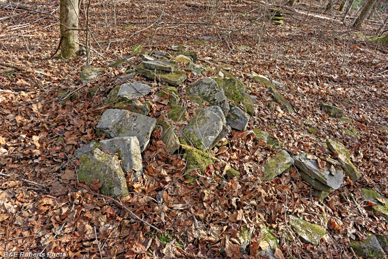
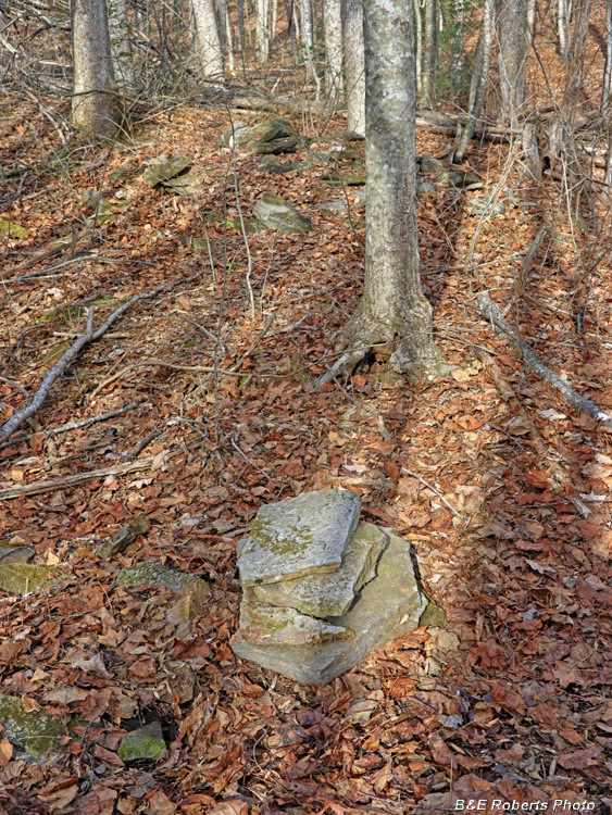
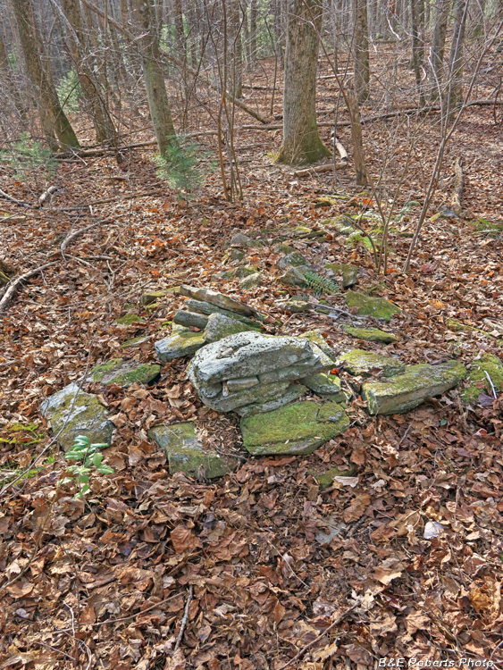
| These stacked rocks supported one of the corners of the old Saxon house. |
|
 |
|
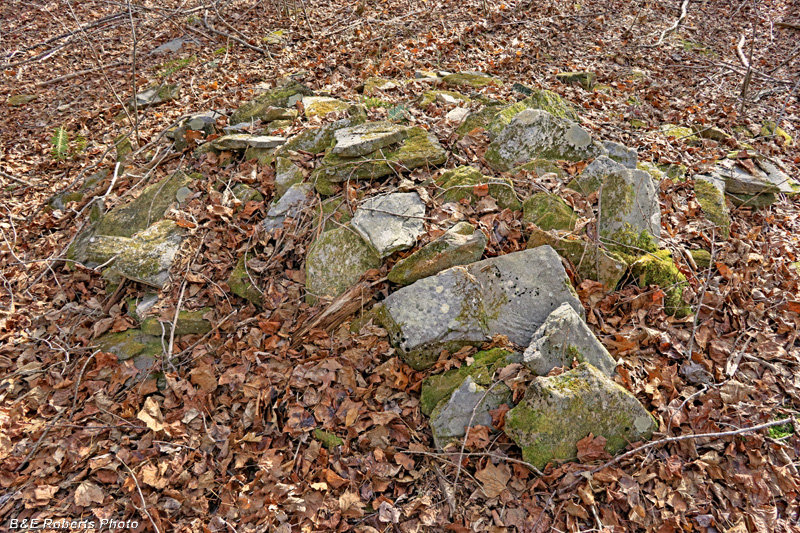
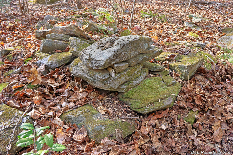
| Stacked foundation rocks with collapsed chimney in background. |
|
 |
|
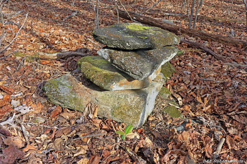
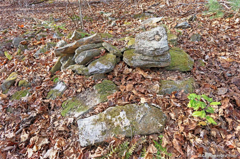
| Rock stack at another corner of the old house site. |
|
 |
|
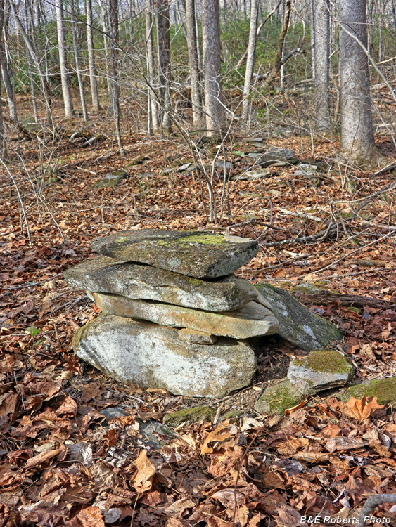
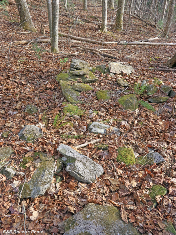
| Corner foundation rocks with collapsed chimney visible in background. |
|
 |
|
| About 100 feet from the main house site lies another collapsed chimney. |
|
 |
|
| Second chimney from another angle |
|
 |
|
| Rather than collapse on itself, this chimney has fallen forward, with its height now spread out on the ground. |
|
 |
|
| Collapsed chimney from opposite side. |
|
 |
|
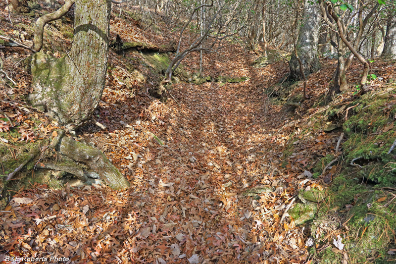
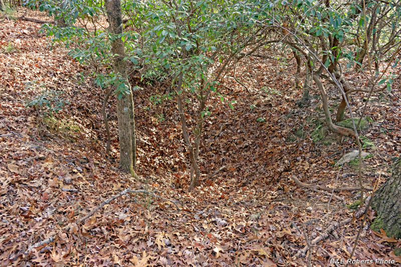
| Cut of the old T. H. Saxon Mica Mine. The old GGS report said it was "100 feet above the home site". What that meant was 100 feet elevation, not distance! |
|
 |
|
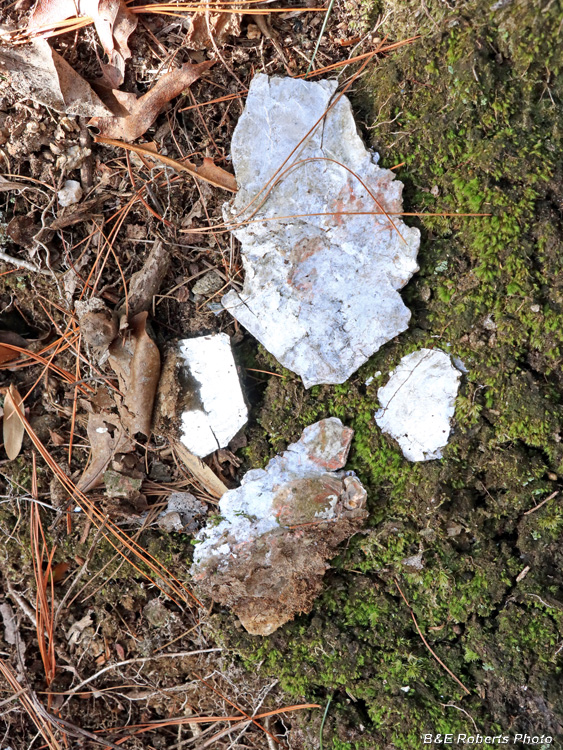
| Scattered pieces of mica around the mine cut... |
|
 |
|
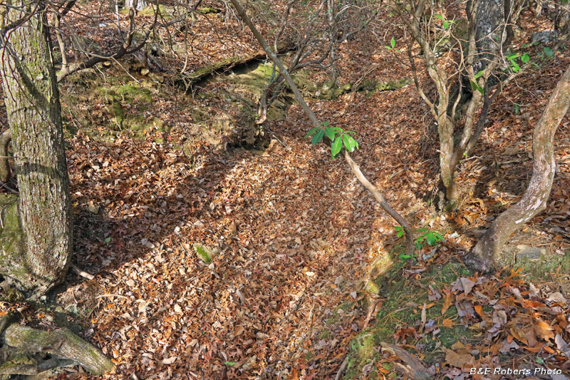
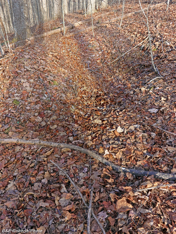
| Another view of the original mica mine cut. |
|
 |
|
| A smaller mine prospect pit is at the top of the ridge, several hundred yards above the main mine cut. |
|
 |
|
| Another prospect cut, on the next prominence. I'd been planning to head back down the mountain after the previous pit, since it was getting late and I had a long walk back to my truck. But it was just over 1/4 mile further to the final site I wanted to look for, and I thought "If I don't go now, I'll have to make another long slog up this mountain in the future". So I decided to make a fast trek up to the final summit... |
|
 |
|
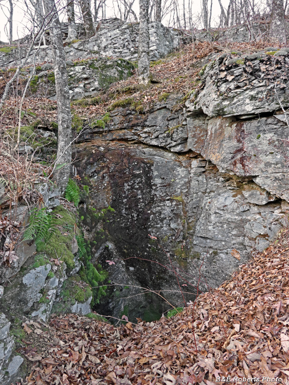
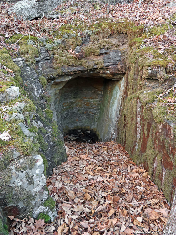
| Just below the summit, the entrance to a hard rock mine shaft. |
|
 |
|
| Moving in a little closer... This shaft is also on the former Saxon property. The old reports don't mention the shaft and tunnels that are cut in the rock here, so I am not sure what was mined here. Perhaps more mica, although I didn't see any in the waste piles. |
|
 |
|
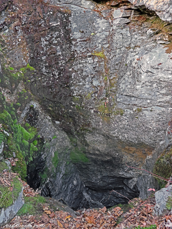
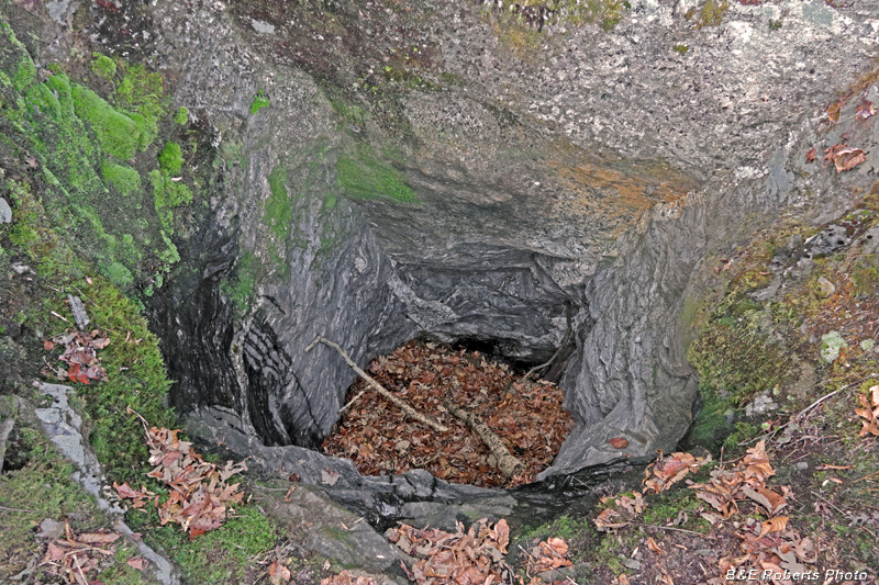
| Looking down the mine shaft, which is about 18 feet deep. |
|
 |
|
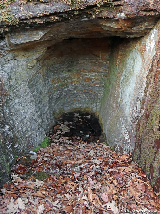
| Nearby is another tunnel-shaft that was aborted after being driven only a short distance horizontally. |
|
 |
|
| A closer look... There is another rock tunnel in the general area, but I didn't have time to look for it this day. |
|
 |
|
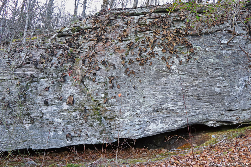
| Lichen-covered boulder that formed one of the cliff faces here... |