| Frankin & Glenn Gold Prospect - Upper Works White County, GA |
All Text & Images: Copyright (2023) |
| Frankin & Glenn Gold Prospect - Upper Works White County, GA |
All Text & Images: Copyright (2023) |
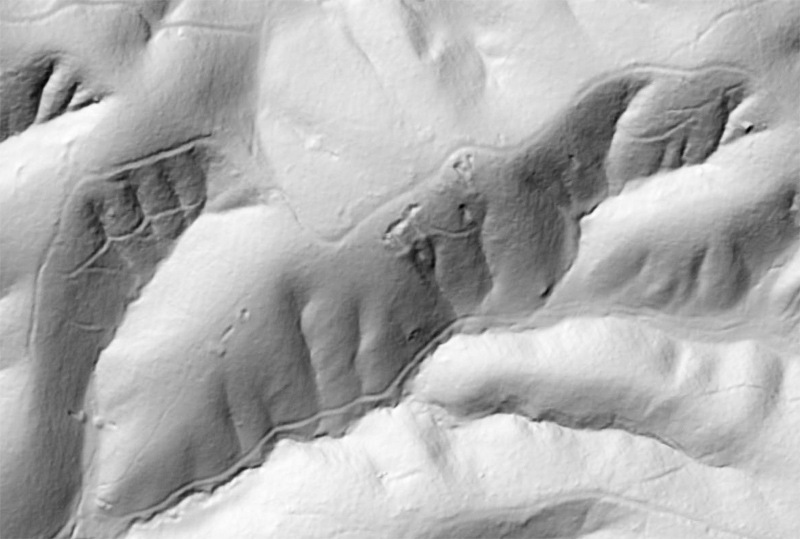
| More research led to the discovery of two additional mine adits at the Franklin & Glenn Lot. Re-reading the reports on this gold prospect, I realized there was more to be seen at the upper ridge, vs. where I had first found the lower adits. From the LIDAR imagery, I marked 3-4 more possible adit locations, and found adits at two of them. The spot that I thought had the highest likelihood of being an adit was sadly slumped, at the end of a large cut. I'm pretty sure that there's another adit behind all the slumped dirt there. I also found a narrow vertical shaft that must lead into another tunnel, but it too would require some major shovel work to clean out. |
|
 |
|
| LIDAR imagery showing evidence of the ridge-top works at the Franklin & Glenn Lot. The original two tunnels that I found two weeks ago can be seen at lower left. |
|
 |
|
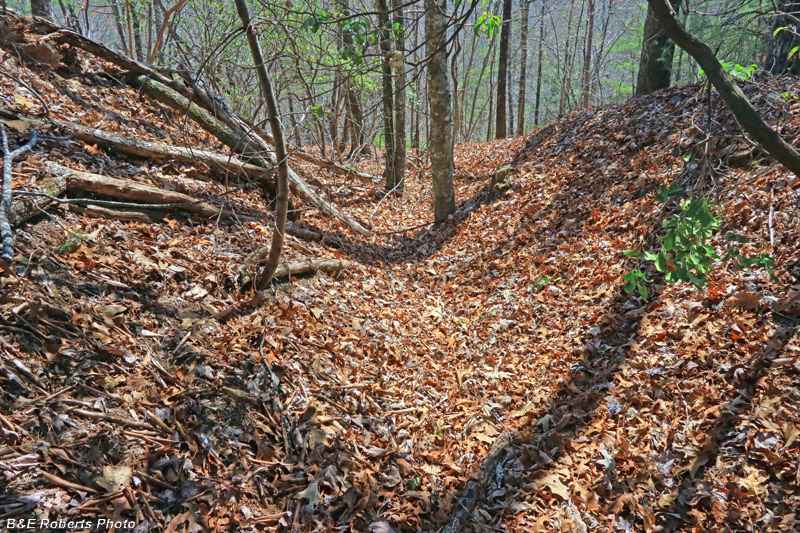
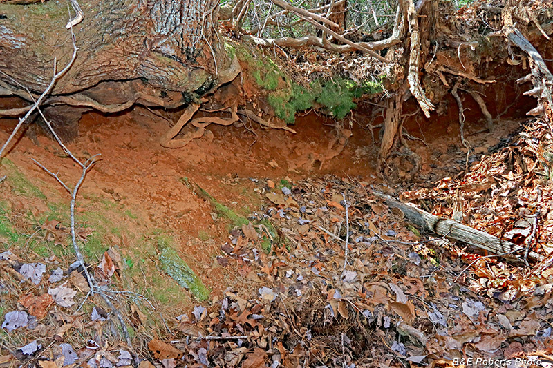
| Half way up the ridge, I encountered a long trench. This is the upper end of that cut. |
|
 |
|
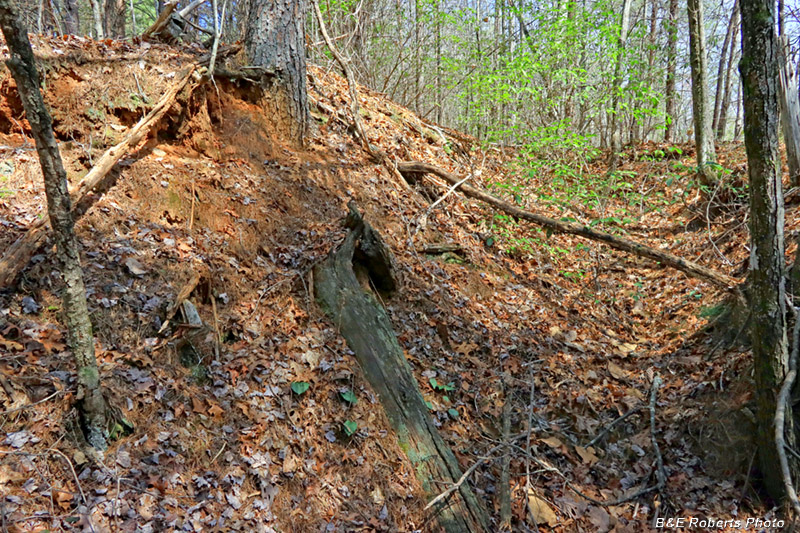
| The ridge-top held a number of trenches, pits and other cuts. |
|
 |
|
| Not great photos here, due to the harsh sun and contrasty shadows... I reduced the contrast in the images the best I could... |
|
 |
|
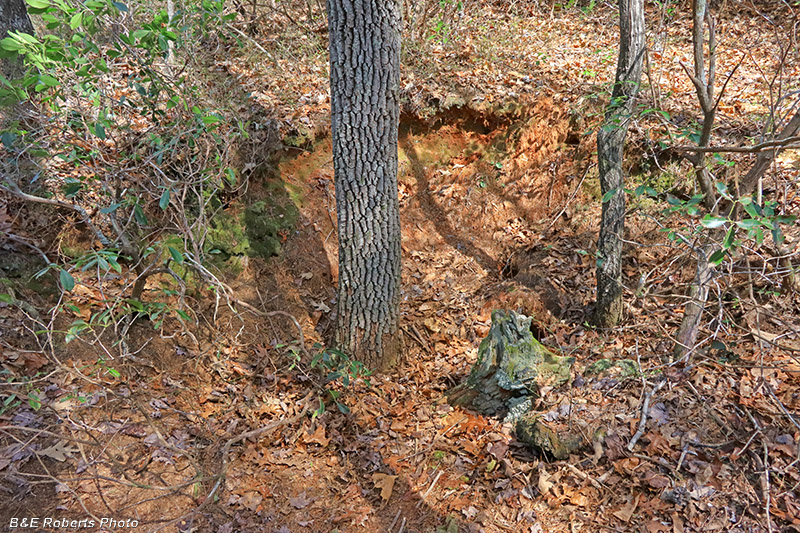
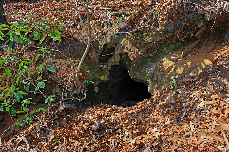
| At the end of one of the mine cuts was a narrow vertical shaft. It goes straight down 8 or 10 feet before bending out of sight. My conjecture is that it opens into another collapsed tunnel. Too small to fit down now, it would require a lot of digging. |
|
 |
|
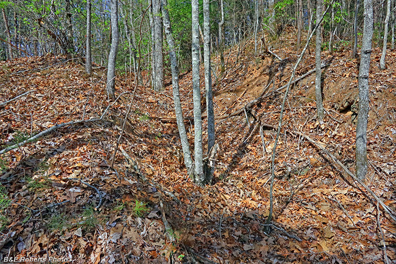
Two more examples of ridge-top mine cuts |
|
 |
|
Coming down off the ridge-top, I started finding more interesting mine-works cut into the steep slopes: |
|
 |
|
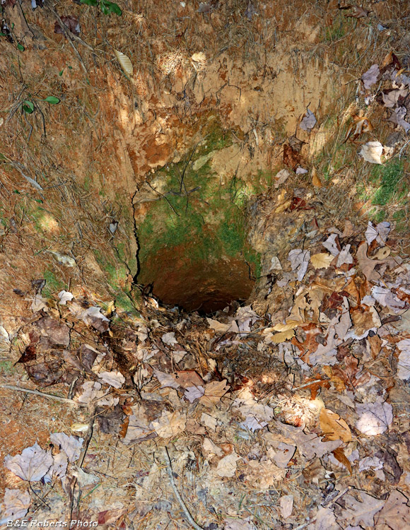
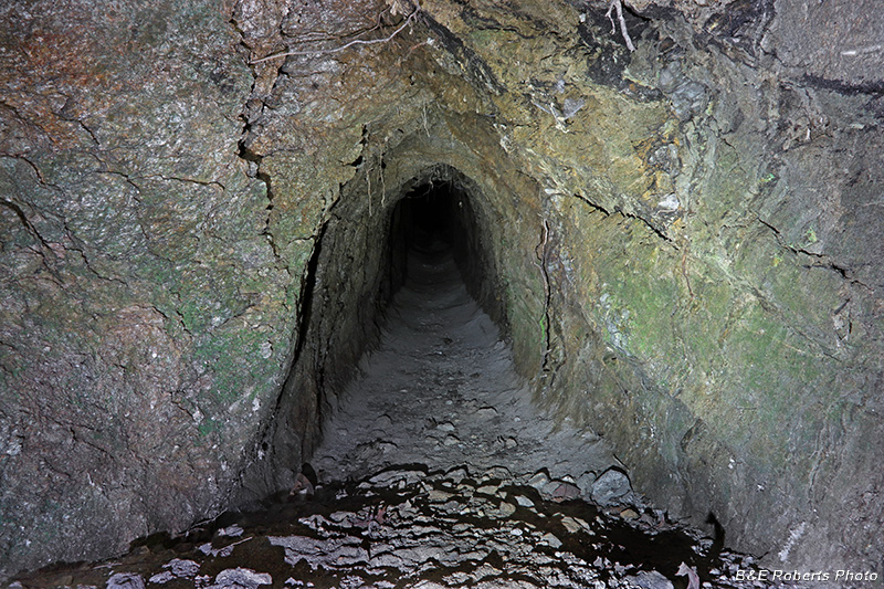
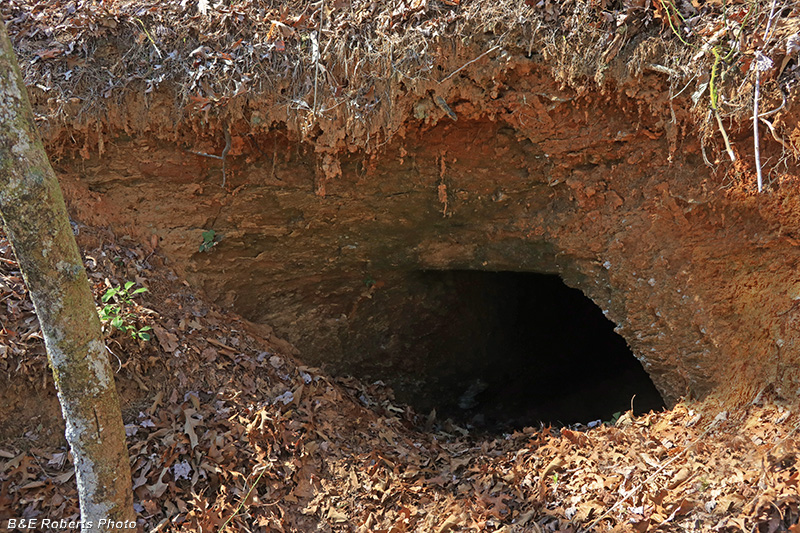
| Entrance to adit 1. Kind of a tight squeeze at the beginning. |
|
 |
|
| Starting down the partially slumped entry into adit 1. |
|
 |
|
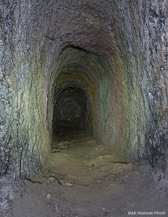
| Reaching the bottom of the slumped area, and into the adit. |
|
 |
|
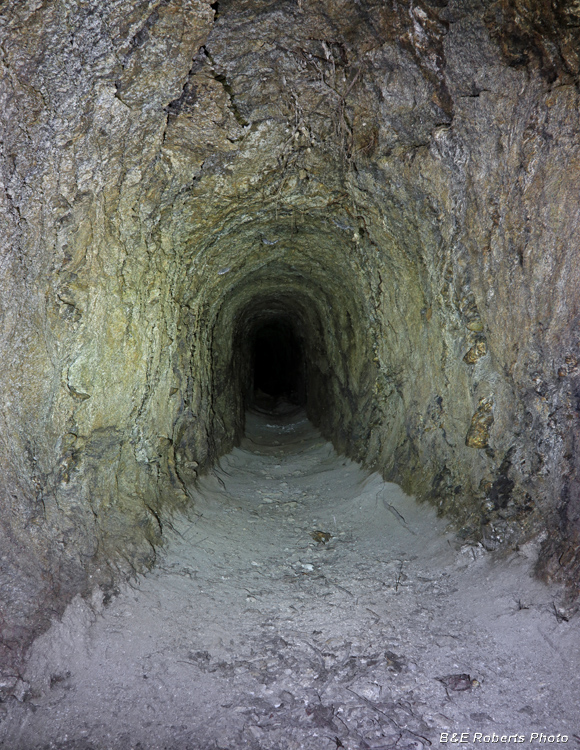
| There was no sign on the floor that anyone or anything had been in here for a long time. |
|
 |
|
| Moving along... |
|
 |
|
| Quartz vein in side of adit wall. |
|
 |
|
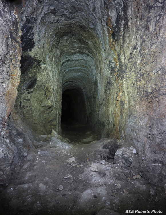
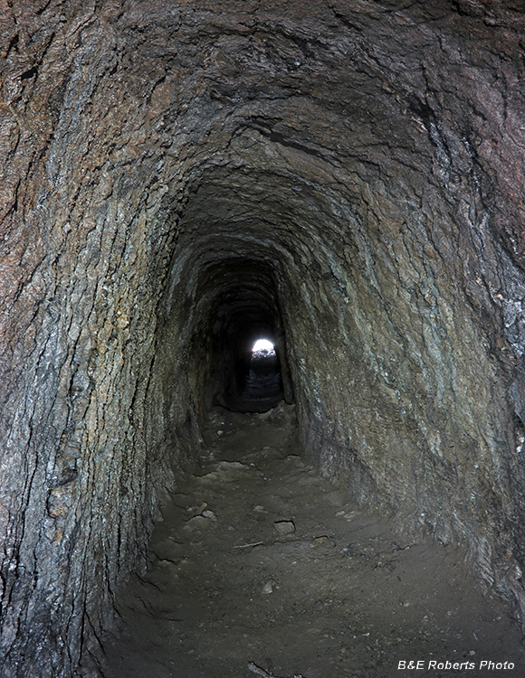
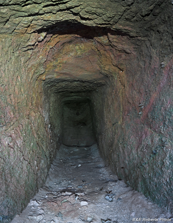
| Continuing on... Adit 1 was about 120 feet in length. |
|
 |
|
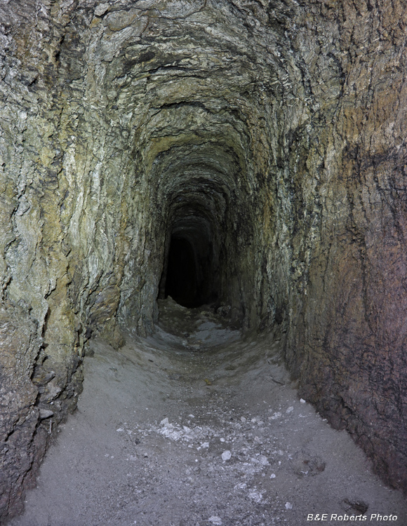
| Approaching the end of the adit. |
|
 |
|
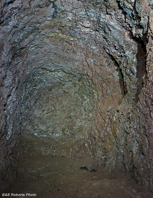
| End of Adit 1. Note the pick marks at bottom of rear wall. |
|
 |
|
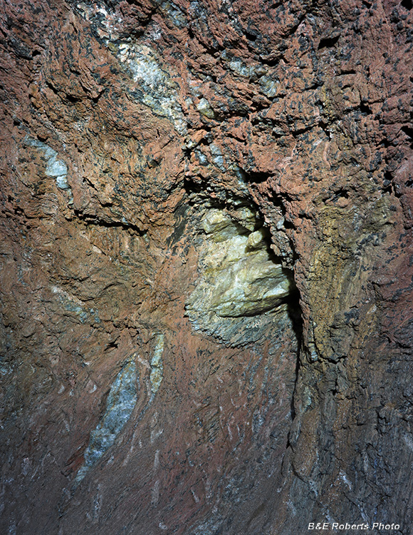
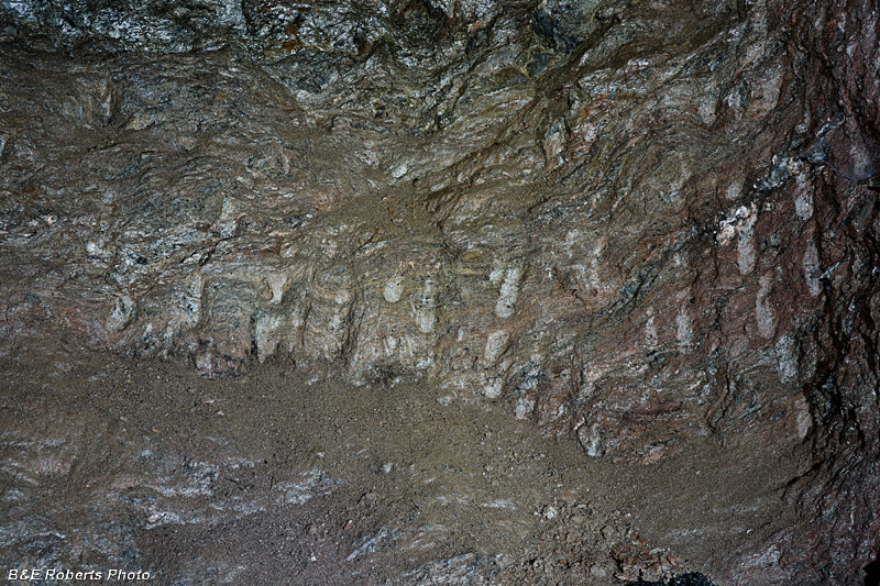
| Close-up of old pick marks on the lower wall, from over 100 years ago. |
|
 |
|
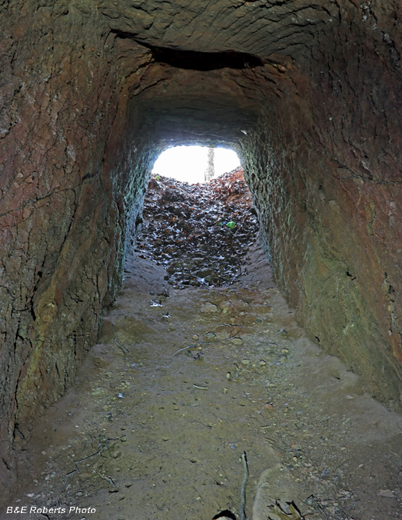
| Heading back out, coming around a curve and seeing light at the end of the tunnel. |
|
 |
|
| Almost back into daylight. |
|
 |
|
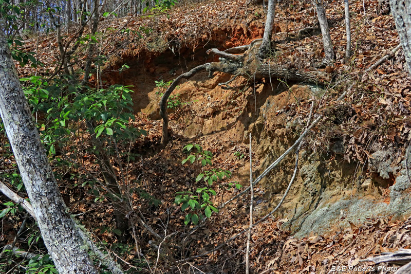
| From the LIDAR image, this was the cut that looked most likely to have a tunnel. From the size of the mining spoils pile removed here, I'd say that the other 100 foot tunnel mentioned in the report was located here. Unfortunately the front of the tunnel has completely slumped, covering the mouth of any tunnel. |
|
 |
|
| A couple hundred yards further along, I came across the entrance to adit 2. |
|
 |
|
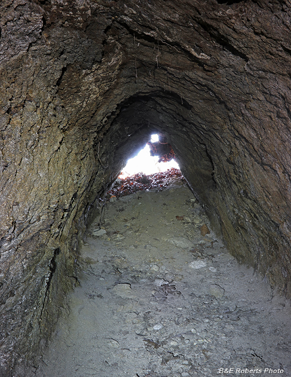
| The mouth was more open than the entry into adit 1. |
|
 |
|
| Adit 2 was only about 30 feet deep.. |
|
 |
|
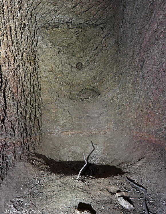
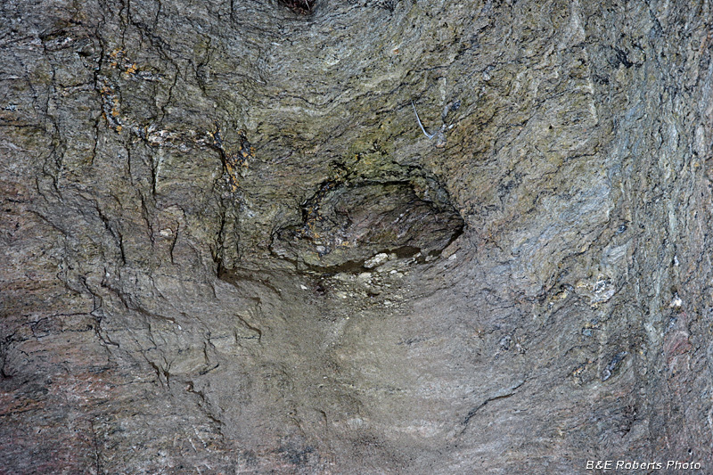
| End of adit 2, with a couple of small cavities in the wall. |
|
 |
|
| Cavities dug out in rear wall, adit 2 |
|
 |
|
| Coming back out of adit 2. |
|
 |
|
| There were several large boulders at the base of the ridge. |