| CCC Camp Gaften (Gafton) Camp F-10, Rabun Co., GA Page 2 - Associated Structures |
All Text & Images: Copyright (2026) |
| CCC Camp Gaften (Gafton) Camp F-10, Rabun Co., GA Page 2 - Associated Structures |
All Text & Images: Copyright (2026) |
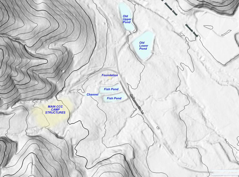
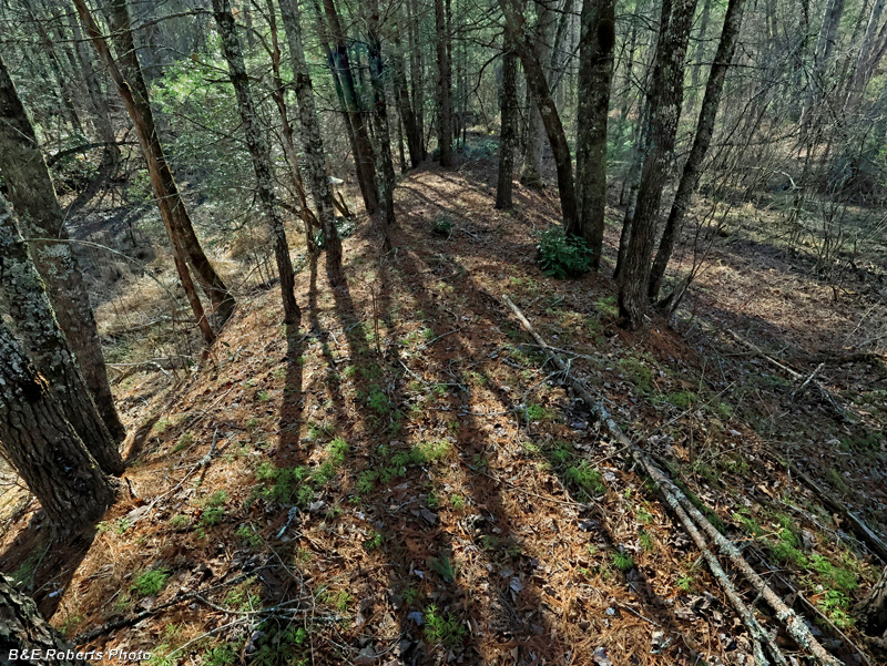
| While originally researching the remains of CCC Camp Gaften, I examined LIDAR maps of the area, and saw a number of interesting landforms that I wanted to check out. I wound up finding two old ponds surrounded by dams and outlets, as well as two smaller fish ponds at another area. (All the ponds were drained long ago and are now much overgrown & wooded). These ponds had other interesting remains associated with them also. |
|
 |
|
| LIDAR map, with the old pond structures annotated. ~ The "Old" Ponds ~ The Lower Pond:: |
|
 |
|
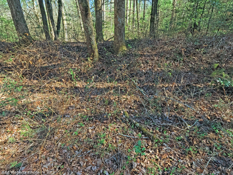
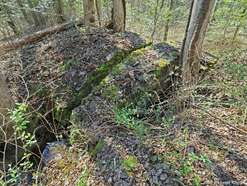
| The two "old" ponds were near the edge of present-day Camp Evergreen. This view is from the interior of the now dry, over-grown lower pond, looking at part of the surrounding dam. |
|
 |
|
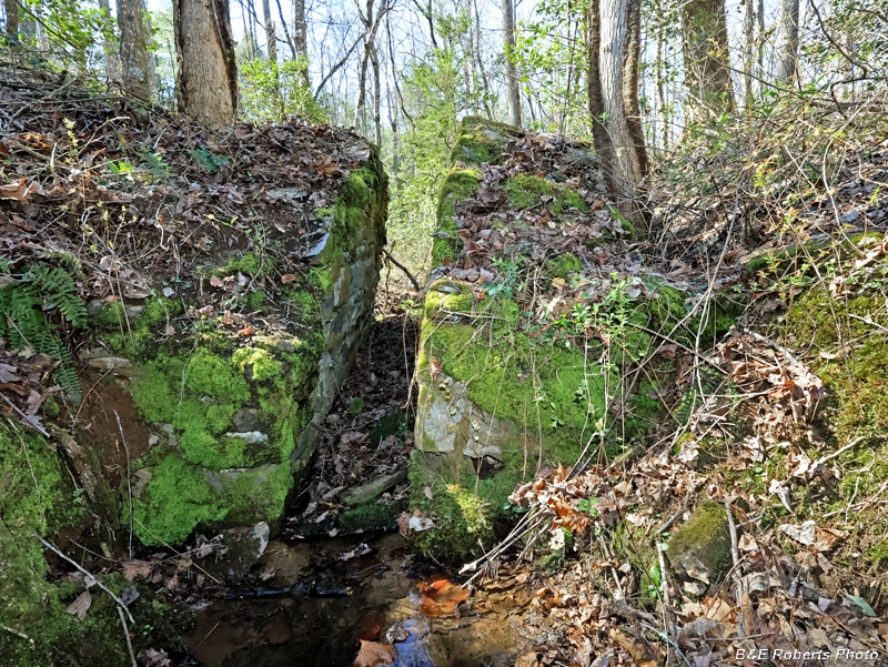
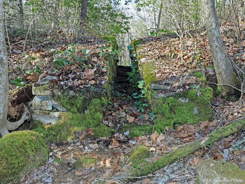
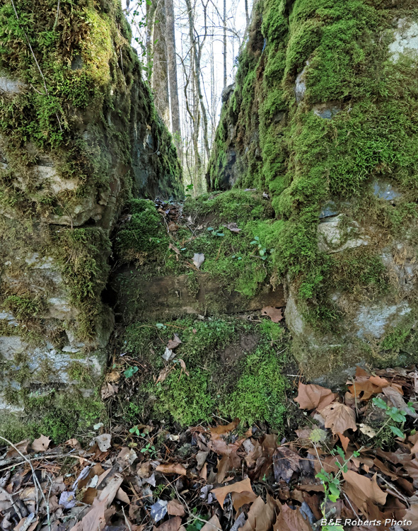
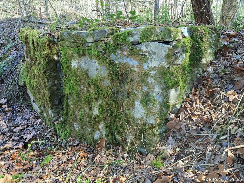
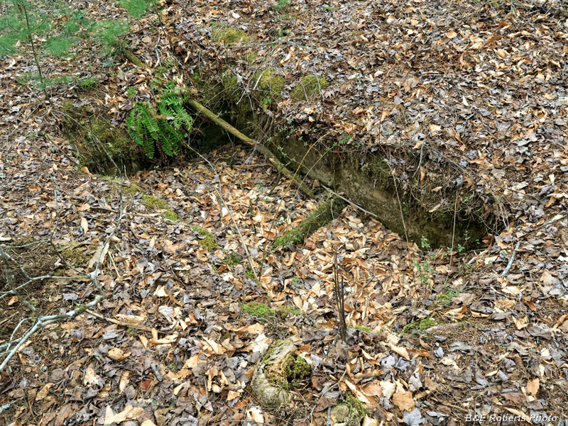
| Both of the two old ponds had outlet gates built into their earthen dams. Each gate consisted of a pair of large mortared-rock bulkheads with a slot between them; the slot held boards which controlled the level of the pond. This is the outlet of the lower pond. Both of the large bulkheads are now tilted at a 10-15 degree angle. I am standing in the creek bed outside (downstream from) the dam. |
|
 |
|
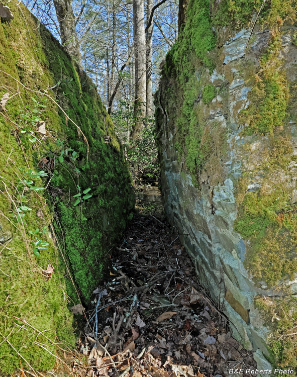
| View through the outlet gate slot. The pond was on the far side. |
|
 |
|
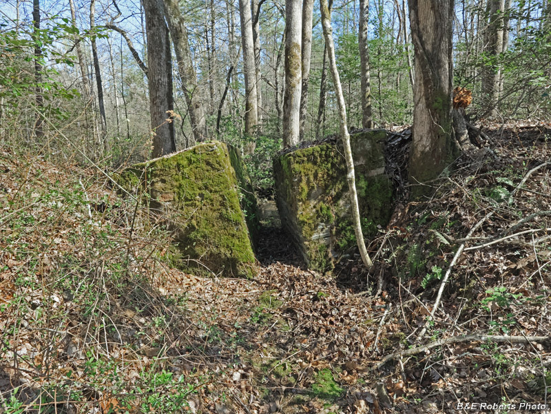
| Standing atop the dam, looking down at the outlet gate. |
|
 |
|
| From the other side of the dam, view down at the outlet gate. |
|
 |
|
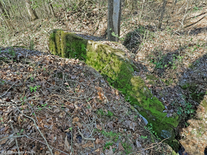
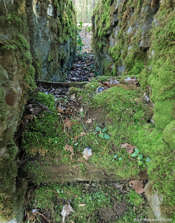
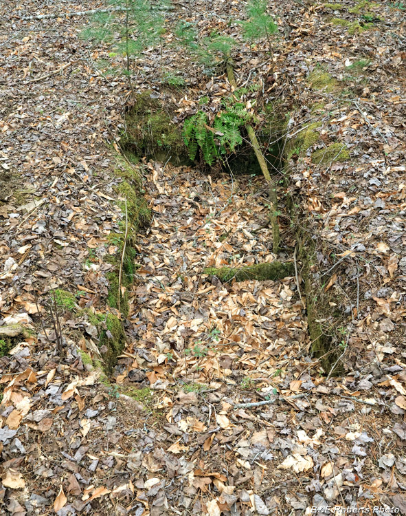
| After walking through the slot, I am now in the former pond's interior, looking downstream at the outlet gate. This view really shows how the outlet gate bulkheads have tilted out of plumb. Probably when the pond emptied, it undermined the base soil. |
|
 |
|
| View downstream through the outlet slot. |
|
 |
|
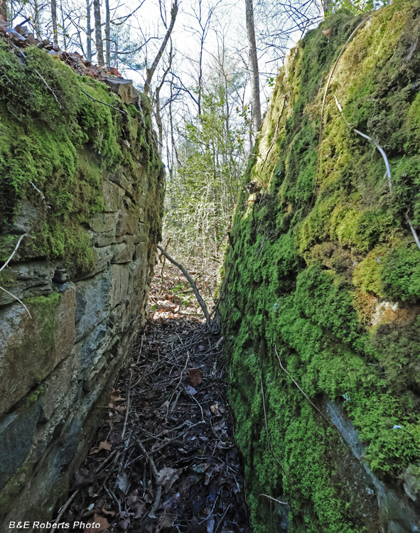
| Looking into the slot at an angle, you can see the channel on one side that held the boards (known as stoplogs) in place. The Upper Pond: |
|
 |
|
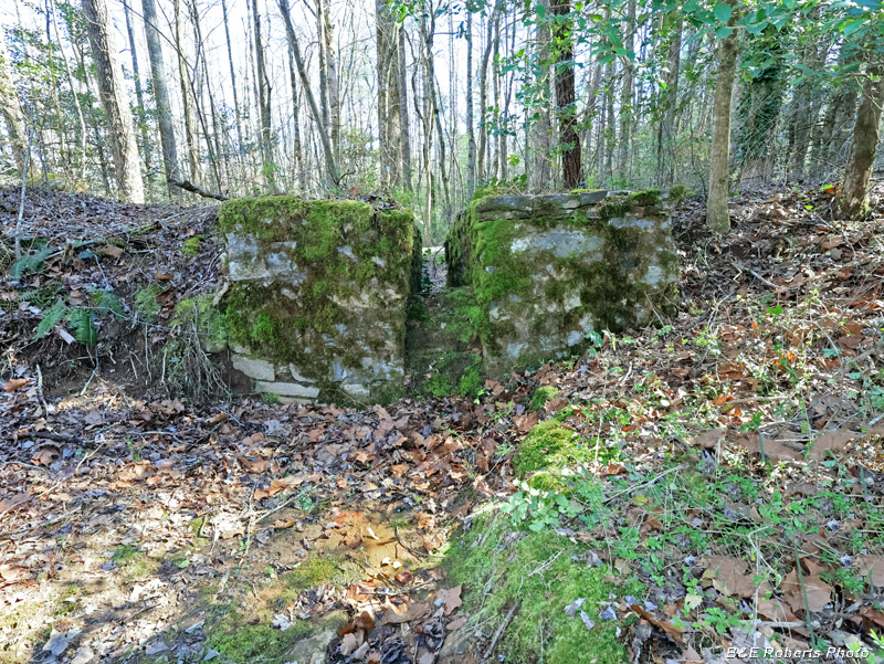
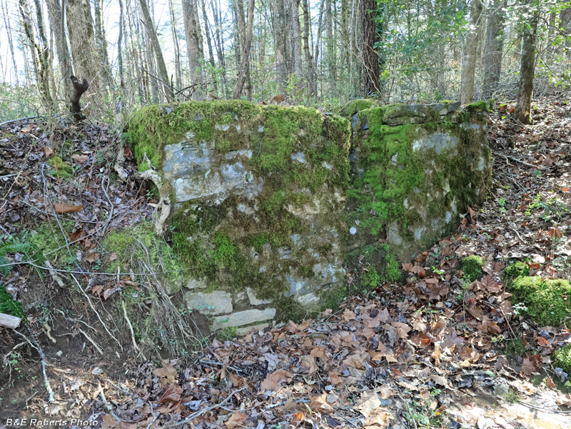
| The outlet gate at the upper pond was smaller, but in better condition. View from below (outside) the upper pond dam. |
|
 |
|
| One bulkhead side has tilted slightly... At the far end of the slot, some of the old stoplog boards are still in place. |
|
 |
|
| After climbing over the dam into the interior of the former pond; view of the outlet gate looking downstream. |
|
 |
|
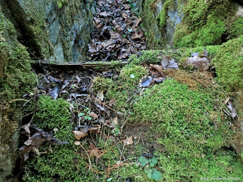
| Note the ancient moss-covered stoplog boards, still in place in the channels of the outlet slot. Although no longer holding back any water... |
|
 |
|
| Stoplog boards I don't know when this pond last held water, but I was amazed to see these boards still in place! |
|
 |
|
| The left stopboard channel is very visible in this image. |
|
 |
|
| Upper pond outlet gate from the left side. |
|
 |
|
| Upper pond outlet gate from the right side. The Fish Ponds:: |
|
 |
|
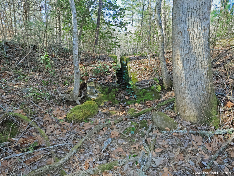
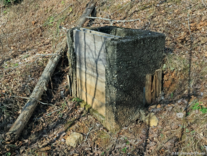
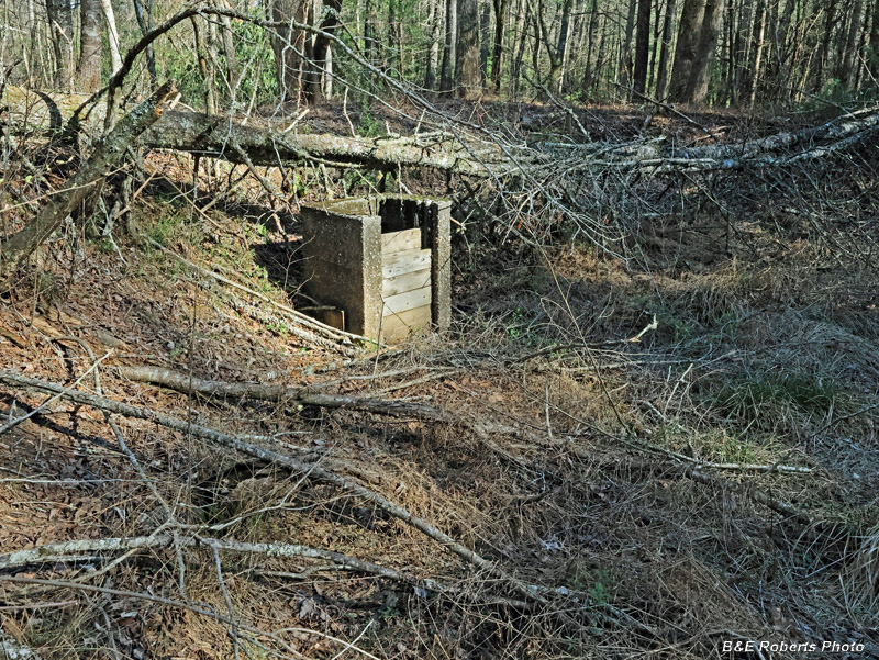
| Back adjacent to the "main" road, I found two adjacent old earthen fish ponds, both with concrete "monk outlets" for drains. . |
|
 |
|
| I don't know if these two ponds were associated with the CCC Camp or the nearby State fish hatchery. I think the latter. They are similar to the old 1940-50s fish-raising pools at the head of the Hiwassee River. |
|
 |
|
| This section of dam separated the two (now empty) fish ponds - one on the left, the other on the right. |
|
 |
|
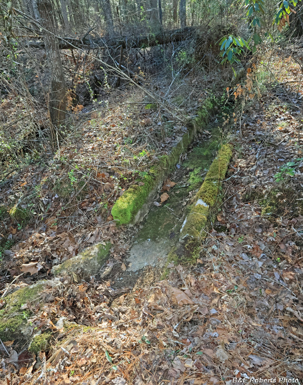
| At the upper end of that mid-dam, a concrete channel carried water to the two fish ponds. |
|
 |
|
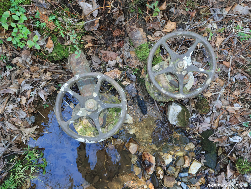
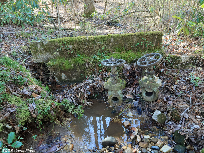
| The water in the concrete channel was diverted from a creek up-slope of the fish ponds, and controlled by these valves. |
|
 |
|
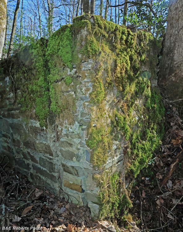
| The creek where the water was diverted from is behind the wall here. |
|
 |
|
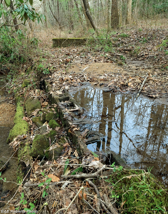
| Diversion dam in the creek, which is now all silted up. The wall next to the water valves in the previous pic can be seen in the rear. |
|
 |
|
| The creek flows in the foreground, from right to left. The rock & concrete block dam created a pool, now completely silted, which was the source for the water which flowed through the valves in the rear, and then down the channel to fill the two fish ponds. |
|
 |
|
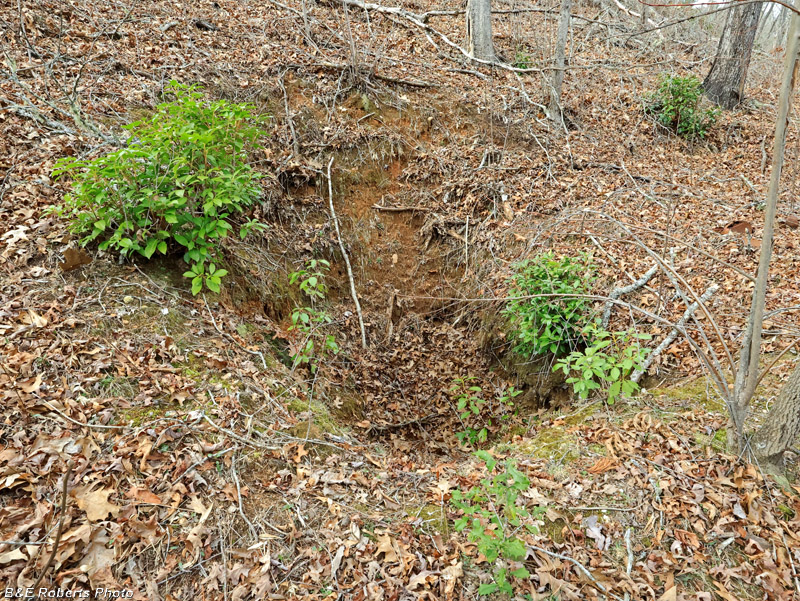
| I had noticed an indication of a pit on LIDAR. About halfway up an adjacent hillside, it is about 10 feet diameter and surrounded on the low side by a rim of excavated dirt. Even though partially collapsed, the pit is still over 12 feet deep. |
|
 |
|
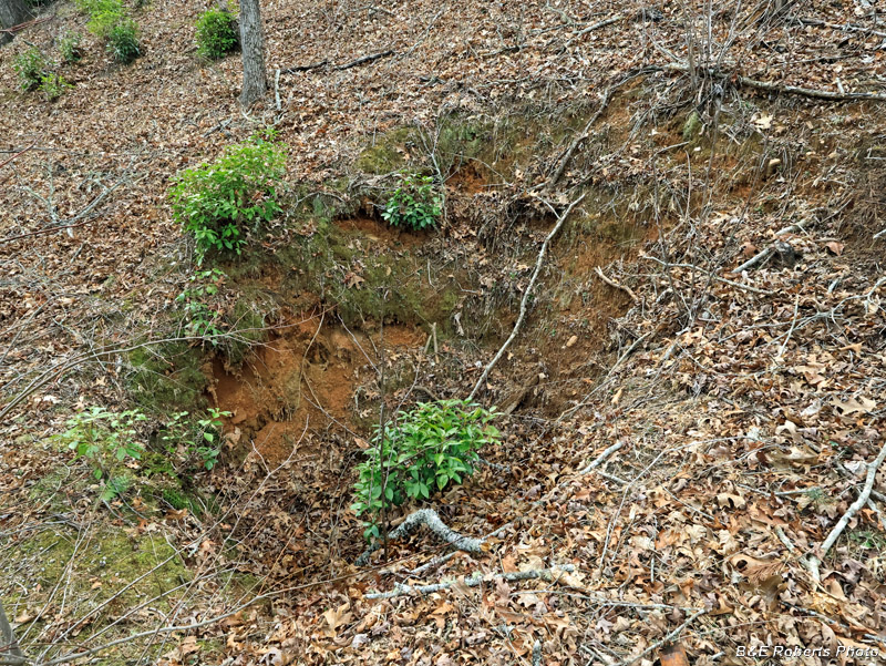
| The pit from another angle. I have no idea what its purpose was; possibly an old mine prospect? There were several old gold mines not far away. |
|
 |
|
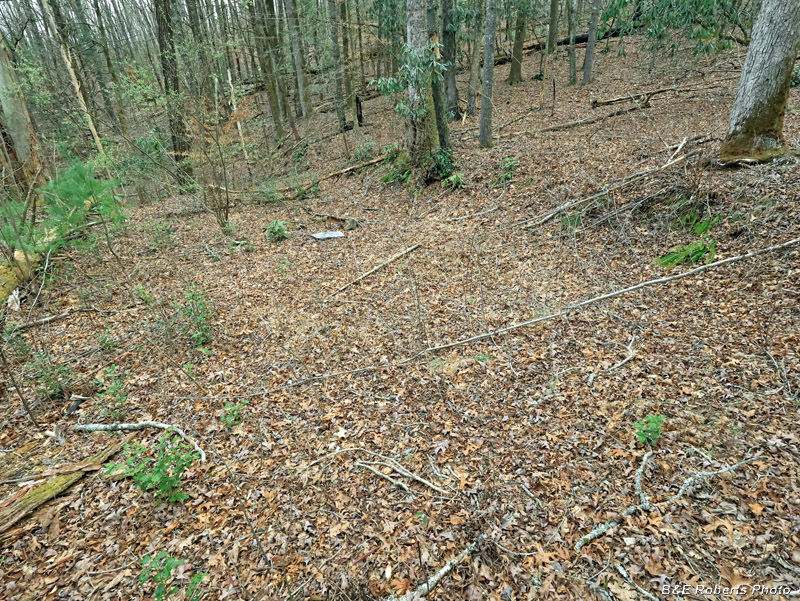
| Another LIDAR indication led me to this area... A flat terrace about 200 x 100 feet, it was cut out on the high side and filled on the lower side to make it level. See next photo for the bright object seen at the far end of the terrace. |
|
 |
|
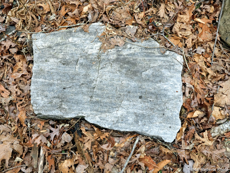
| This flat, smooth-faced slab of marble-like rock is laying in the large flat terrace. About 28 x 20 inches, and a couple of inches thick. |
|
 |
|
| This old excavation is about the size of an adult grave, although not as deep. I have no idea what it was for. |
|
 |
|
| Another view of the rectangular excavation. Back to Page 1 - "Main CCC Camp" |